
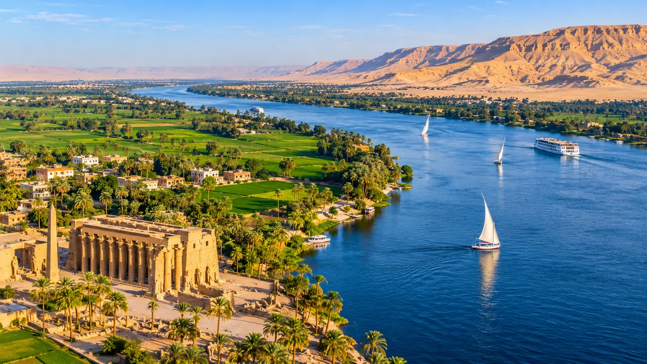
Quick Answer: How long is the Nile River?
The Nile River is approximately 6,650 kilometers (4,130 miles) long, stretching from the headwaters of East Africa to the Mediterranean Sea in northern Egypt. Some authorities use a longer estimate of 6,695 kilometers (4,160 miles), depending on how the river is measured. The Nile is traditionally recognized as the world’s longest river, although its ranking against the Amazon remains debated.
The Nile is more than a remarkable geographical feature. It connects tropical lakes, wetlands, highlands, deserts, and fertile agricultural valleys across northeastern Africa. Its waters supported the development of Ancient Egyptian civilization and continue to shape life in modern Egypt.
For travelers, one particularly interesting fact is that only about 1,532 kilometers (952 miles) of the Nile’s commonly reported length lie within Egypt, according to an Egyptian government geographical estimate. The rest of its enormous journey belongs to a river system extending across several African countries.
The Nile also presents a geographical puzzle: its White Nile and Blue Nile tributaries have different origins, and identifying the river’s most distant source is not as straightforward as pointing to one lake.
Understanding the Nile’s length, route, and history makes Egypt’s landscapes easier to appreciate, particularly when visiting Cairo, Luxor, Aswan, or the temples along the river.
How Long Is the Nile River in Kilometers, Miles, and Meters?
The Nile River is commonly described as 6,650 kilometers long, equivalent to approximately 4,132 miles or 6.65 million meters.
However, geographical organizations do not all report exactly the same measurement. The Nile Basin Initiative and Guinness World Records have published a longer figure of 6,695 kilometers, approximately 4,160 miles.
Neither figure means the river has suddenly become longer or shorter. The difference largely reflects the methods used to identify its source, trace its channels, and determine the endpoint of the measurement.
Nile River Length: Quick Facts
| Measurement | Approximate Nile River Length |
|---|---|
| Commonly quoted length | 6,650 km |
| Length in miles | 4,130–4,132 miles |
| Length in meters | 6,650,000 meters |
| Alternative published estimate | 6,695 km |
| Alternative estimate in miles | 4,160 miles |
| Length within Egypt | Approximately 1,532 km |
| Egyptian section in miles | Approximately 952 miles |
| General flow direction | South to north |
| Final destination | Mediterranean Sea |
| Main tributaries | White Nile and Blue Nile |
| Continent | Africa |
These measurements describe the river’s winding course rather than a straight line between its source and its mouth.
A river can cover substantially more distance than a road or flight following the same general direction because natural channels contain bends, curves, and branching sections.
How Long Is the Nile River in Miles?
The standard figure of 6,650 kilometers converts to approximately 4,132 miles, commonly rounded to 4,130 miles.
Some references give 4,160 miles because they use the 6,695-kilometer measurement.
For travelers from the United States and other countries using miles, both numbers describe the same remarkable geographical scale: the Nile’s complete African system extends over four thousand miles.
It would be incorrect, however, to assume that visitors can travel those 4,130 miles on one continuous Nile cruise.
Most Egyptian river cruises cover only a comparatively short section of the Nile between Luxor and Aswan.
How Long Is the Nile River in Meters?
Using the conventional 6,650-kilometer measurement, the Nile River is approximately 6,650,000 meters long.
This conversion is straightforward:
6,650 kilometers × 1,000 = 6,650,000 meters.
If the alternative 6,695-kilometer estimate is used, the result is 6,695,000 meters.
Meters are useful for scientific and engineering measurements, but kilometers and miles are more practical when describing the river’s full geographical length.
Why Do Different Sources Give Different Lengths for the Nile?
Measuring the Nile River is more complicated than measuring the distance between two cities.
The river does not begin as one clearly marked channel. Instead, its upstream system contains numerous lakes, streams, tributaries, and wetlands.
Geographers must decide which continuous watercourse represents the longest route to the Mediterranean Sea.
Several factors affect the result.
1. Identifying the Most Distant Source
Lake Victoria is widely identified as the principal source lake associated with the White Nile.
Yet rivers flow into Lake Victoria from surrounding highlands. Some of those tributaries begin far beyond the lake’s shores.
If a measurement begins at Lake Victoria’s outlet, the result will be shorter than one starting at the most distant connected headwater.
The Kagera River system, whose headwaters extend into the highlands of Rwanda and Burundi, plays an important role in the debate over the Nile’s ultimate source.
Different interpretations of this system can produce different total lengths.
2. Following the River’s Natural Curves
The Nile is not a straight watercourse.
It bends through different geological landscapes, especially in Sudan, where its course includes a broad loop often called the Great Bend of the Nile.
Accurate measurements must follow the river channel, including its major curves.
Modern satellite mapping has improved geographical measurement, but the precise route selected still matters.
3. Accounting for Branching Channels
Near the Mediterranean, the Nile divides into the two principal distributaries of its modern delta.
These are the Rosetta branch in the west and the Damietta branch in the east.
The choice of terminal channel and endpoint can influence the distance reported.
4. Distinguishing a River From Its Wider Basin
The Nile River and the Nile Basin are related but different geographical concepts.
The river is the connected watercourse being measured.
The basin is the much larger area of land drained by the river and its tributaries.
A country can belong to the Nile Basin without the main river passing directly through it.
This distinction becomes important when discussing the countries associated with the Nile.
What measurement should travelers use?
For general travel information, 6,650 kilometers (4,130 miles) is a clear, widely recognized answer.
For more detailed geographical discussion, acknowledge that some established authorities report approximately 6,695 kilometers (4,160 miles).
There is no need to present one figure as an absolutely precise measurement when the definition itself remains disputed.
Where Is the Nile River Located?
The Nile River is located in northeastern Africa, where its connected river system extends from the Great Lakes region and the Ethiopian Highlands toward Sudan and Egypt.
Its waters ultimately reach the Mediterranean Sea through the Nile Delta.
Although the river is most closely associated with Egypt, most of its upstream system lies beyond Egyptian territory.
The Nile links several contrasting environments, including tropical highlands, freshwater lakes, extensive wetlands, savannas, dry plains, and the Sahara Desert.
This geographical variety helps explain why a single river can look so different depending on where it is observed.
Understanding the Nile River Map
A map of the Nile River should show the main river alongside its two most important tributaries.
The White Nile system extends northward from the Great Lakes region.
The Blue Nile originates in the Ethiopian Highlands and flows northwest toward Sudan.
The two tributaries meet at Khartoum, Sudan’s capital, forming the principal Nile channel that continues northward toward Egypt.
A simplified geographical route looks like this:
Great Lakes region → White Nile → Khartoum → Sudan → Lake Nasser → Aswan → Luxor → Cairo → Nile Delta → Mediterranean Sea
The Blue Nile joins this system at Khartoum after traveling from Ethiopia.
This simplified route helps explain the river’s general geography, although it does not show every tributary, bend, lake, or reservoir.
Why Does the Nile Flow North?
The Nile River flows generally north because its waters move downhill toward the Mediterranean Sea.
River flow is determined by differences in elevation, not by compass direction.
The Nile’s upstream regions include elevated areas of East Africa and Ethiopia, while its ultimate destination is at sea level.
Gravity carries water from higher elevations toward lower elevations through the river system.
The Nile’s northward direction is sometimes presented as unusual, but many rivers around the world also flow north.
There is no geographical rule requiring rivers to flow south.
Upper Egypt and Lower Egypt: Why the Names Seem Reversed
A particularly interesting aspect of Egyptian geography is that Upper Egypt lies in the south, while Lower Egypt lies in the north.
The terminology reflects the Nile’s direction of flow and the relative elevation of the landscape.
Upper Egypt refers to the upstream Nile Valley, including major areas around Luxor and Aswan.
Lower Egypt refers to the downstream northern region, particularly the Nile Delta.
This distinction appeared in Ancient Egyptian geography and political symbolism.
A traveler moving south from Cairo to Luxor is therefore traveling toward Upper Egypt, even though Luxor appears lower on a conventional north-up map.
Where Does the Nile River Start?
The Nile River’s ultimate source is generally associated with the headwaters feeding the White Nile system in the East African Great Lakes region.
Lake Victoria is the best-known source lake, but the river system extends upstream through tributaries, including the Kagera.
The Blue Nile has a separate source system in Ethiopia.
Consequently, answering where the Nile begins requires distinguishing between the White Nile, the Blue Nile, and the most distant headwaters used to calculate the river’s total length.
Lake Victoria and the White Nile
Lake Victoria is one of Africa’s largest freshwater lakes and occupies an important position in the Nile’s upper drainage system.
The lake borders Uganda, Tanzania, and Kenya.
Water leaves Lake Victoria at Jinja in Uganda and enters the Victoria Nile.
From there, it flows through a series of waterways and lakes, including Lake Kyoga and Lake Albert, before continuing northward.
Farther downstream, the river system passes through South Sudan.
The White Nile is especially important because it helps sustain the Nile’s flow across different seasons.
Its upstream lakes and wetlands regulate the movement of water through parts of the river system.
The Kagera River and the Search for the Nile’s True Source
The Kagera River is an important tributary of Lake Victoria and forms part of the Nile’s longest potential headwater route.
Its upstream network extends into the highlands of Rwanda and Burundi.
The debate is not simply about which country contains the Nile’s source.
Geographers must determine which tributary is longest, whether it provides a continuous hydrological route, and how the source should be defined.
Some geographical conventions identify a distant headwater in Burundi, while others consider alternative upstream routes associated with Rwanda.
That is why a simple statement such as “the Nile starts in Uganda” provides only part of the answer.
Uganda contains the recognized outlet of Lake Victoria, but the farthest waters connected to the Nile begin farther upstream.
Lake Tana and the Blue Nile
The Blue Nile originates in the Ethiopian Highlands, with Lake Tana serving as its principal source lake.
From Ethiopia, the Blue Nile travels through dramatic highland terrain before entering Sudan.
It joins the White Nile at Khartoum.
The Blue Nile contributes a major share of the Nile’s annual water volume, particularly during the Ethiopian rainy season.
Historically, it also carried much of the sediment that helped enrich agricultural land downstream.
The distinction is important:
-
White Nile: Associated with the East African Great Lakes and the Nile’s longest headwater system.
-
Blue Nile: Associated with Ethiopia’s Lake Tana and a major contribution to the river’s seasonal flow.
-
Main Nile: Formed at the confluence of the White and Blue Nile at Khartoum.
Together, these watercourses create the river that continues north through Sudan and Egypt.
Where Does the Nile River Start and End?
The Nile’s longest headwater system begins in the East African Great Lakes region, with distant tributaries reaching into Rwanda and Burundi.
The river ends in the Mediterranean Sea on Egypt’s northern coast.
Between these two ends, the river passes through several distinct geographical regions.
The Nile’s Journey Across Africa
Stage 1: The East African headwaters
Rainfall feeds rivers and streams that drain into Lake Victoria and the wider Great Lakes system.
This region provides important upstream watercourses associated with the White Nile.
Stage 2: Uganda and the lake system
Water leaves Lake Victoria and continues through Uganda, connecting with other lakes and rivers along the way.
The course includes substantial changes in landscape and water flow.
Stage 3: South Sudan and the Sudd wetlands
The Nile system enters South Sudan, where it passes through the extensive Sudd wetland complex.
The Sudd is one of Africa’s most significant wetland environments.
Its slow-moving channels, vegetation, and floodplains influence the movement and loss of water through evaporation and plant activity.
Stage 4: The White Nile in Sudan
The river continues north as the White Nile.
Its waters eventually reach Khartoum, where they meet the Blue Nile.
Stage 5: The meeting of the two Niles
At Khartoum, the White Nile and Blue Nile unite.
This confluence marks one of the Nile system’s most recognizable geographical points.
Stage 6: Northern Sudan
The main Nile follows a winding course through Sudan.
Its path includes rocky sections and historic cataract regions that once complicated navigation.
Stage 7: Lake Nasser and southern Egypt
The Nile enters the reservoir system associated with the Aswan High Dam.
Lake Nasser occupies a major part of the river’s modern course in southern Egypt, with the reservoir extending into northern Sudan.
Stage 8: The Egyptian Nile Valley
Below the Aswan High Dam, the river continues past Aswan, Luxor, and numerous communities in Upper Egypt.
This is the stretch most closely associated with Egyptian river cruises and several major ancient temples.
Stage 9: Cairo and the Nile Delta
The river reaches the Cairo region before dividing downstream into the Nile Delta.
Its two principal modern branches are the Rosetta and Damietta distributaries.
Stage 10: The Mediterranean Sea
The Nile’s waters eventually reach the Mediterranean along Egypt’s northern coastline.
This marks the end of its long journey across Africa.
Does the Nile Have One Mouth or Several?
The Nile has a branching delta rather than one simple river mouth.
Its two main distributaries are the Rosetta branch, also known as Rashid, and the Damietta branch.
These channels carry water toward the Mediterranean Sea and form the principal framework of the modern Nile Delta.
The ancient delta once contained additional distributaries, some of which changed course or disappeared over time.
Sediment deposition, natural changes in river channels, and human water management have all influenced the delta’s development.
For visitors, the delta offers a different Nile landscape from the narrow green valley surrounding Luxor and Aswan.
Instead of a river bordered by desert cliffs, the northern region contains extensive agricultural land, waterways, towns, and coastal environments.
How Many Countries Are Connected to the Nile River?
The Nile Basin extends across 11 African countries, although the main river does not physically flow through every one of them.
This difference is frequently overlooked in simplified descriptions of the Nile.
The countries associated with the Nile Basin are:
-
Egypt
-
Sudan
-
South Sudan
-
Uganda
-
Tanzania
-
Kenya
-
Rwanda
-
Burundi
-
Ethiopia
-
Democratic Republic of the Congo
-
Eritrea
Some countries contain major river channels, while others contribute through tributaries, lakes, or drainage areas.
For example, Ethiopia is essential to the Blue Nile system, while Kenya and Tanzania share Lake Victoria and portions of its catchment.
Egypt lies at the downstream end of this interconnected river network.
Why Is the Nile Basin Important?
The Nile Basin covers approximately 3.2 million square kilometers, although published calculations of its drainage area vary according to delineation methods.
It is one of Africa’s most important shared water systems.
The basin supports drinking water supplies, agriculture, fishing, transport, wetlands, ecosystems, and electricity generation.
Because the river crosses international boundaries, changes in upstream water use can have consequences farther downstream.
Water management therefore involves several countries with different geographical conditions and economic needs.
For travelers interested in Egypt, this broader perspective matters.
The Nile visible from a cruise ship near Luxor depends on a much larger hydrological system extending beyond Egypt.
The river’s history is Egyptian, Sudanese, Ethiopian, East African, and international—not Egyptian alone.
Is the Nile Still the Longest River in the World?
The Nile is still traditionally recognized as the world’s longest river, but the classification remains disputed.
Guinness World Records credits the Nile with a length of approximately 6,695 kilometers.
However, some researchers have argued that the Amazon River in South America may be longer when alternative sources and channels are included.
The central problem is deciding exactly where each river begins and ends.
Nile River vs. Amazon River
| Feature | Nile River | Amazon River |
|---|---|---|
| Continent | Africa | South America |
| Commonly cited length | About 6,650 km | About 6,400 km |
| Alternative length estimates | About 6,695 km | Some estimates exceed 6,700 km |
| Main outlet | Mediterranean Sea | Atlantic Ocean |
| Main geographical significance | Traditionally the longest river | Largest river by water discharge |
| Key source debate | White Nile headwaters | Andean tributaries |
| Famous landscapes | African lakes, wetlands, Sahara, Nile Valley | Andes, tropical rainforest, Amazon Basin |
The figures are approximate and are not based on one universally agreed measurement method.
Which Is Longer, the Amazon or the Nile?
Under the traditional geographical classification, the Nile is longer than the Amazon.
However, studies using different source definitions have produced Amazon measurements that potentially exceed those of the Nile.
NASA has discussed this uncertainty when examining competing estimates of Amazon River length.
It is therefore more accurate to say that the Nile is traditionally recognized as the longest river rather than to suggest the scientific question has been resolved beyond dispute.
Which River Carries More Water?
The Amazon carries substantially more water than the Nile.
The Amazon’s enormous drainage basin receives considerable tropical rainfall and includes numerous major tributaries.
By comparison, much of the Nile’s lower course travels through extremely dry regions.
A river’s length and its discharge are different measurements.
Length describes the distance along the channel.
Discharge describes the volume of water moving through the river over time.
The Nile can therefore be longer under traditional measurements while the Amazon carries far more water.
Why the Debate Matters
The Nile–Amazon comparison illustrates an important principle in geography: natural features are not always as easy to measure as they first appear.
A mountain’s height requires an agreed reference level.
A coastline’s length changes with measurement scale.
A river’s length depends on its defined source and endpoint.
The Nile’s ranking is interesting, but its historical and geographical importance does not depend on winning a numerical comparison.
How Long Is the Nile River in Egypt?
The Nile River extends for approximately 1,532 kilometers (952 miles) within Egypt, according to a geographical description published by Egypt’s State Information Service.
This represents the downstream Egyptian section rather than the full length of the river across Africa.
The Nile enters southern Egypt through the Lake Nasser region and continues northward toward the Mediterranean Sea.
Its course passes through some of the country’s most historically important regions.
How Does the Nile Travel Through Egypt?
The Egyptian Nile can be understood in four broad geographical sections.
| Nile Region | Main Characteristics | Travel Significance |
|---|---|---|
| Lake Nasser and southern Nubia | Large reservoir, desert scenery, Nubian heritage | Lake Nasser cruises and Abu Simbel excursions |
| Aswan and Upper Egypt | Islands, granite landscapes, temples, agricultural settlements | Felucca sailing, Philae, Elephantine Island |
| Luxor and the central Nile Valley | Ancient temple complexes, tombs, farming villages | Major Nile cruise routes and archaeological excursions |
| Cairo and the Nile Delta | Urban waterfronts, bridges, irrigation networks, delta branches | Cairo river experiences and northern Egyptian geography |
Each section offers a different understanding of the Nile.
Southern Egypt: The Nile Around Aswan
Aswan is one of the most visually distinctive places to experience the river.
Granite rocks, islands, palm trees, and traditional sailing boats create a landscape unlike the wide agricultural sections farther north.
The river has historically connected communities in Upper Egypt and Nubia.
Modern visitors can explore the waterfront, observe river traffic, and travel by boat to nearby islands.
The city of Aswan is also a practical starting or ending point for many Nile cruise itineraries.
One of the area’s most interesting locations is Elephantine Island, which contains archaeological remains associated with the ancient frontier between Egypt and Nubia.
The island helps visitors understand why control of river routes mattered for trade, administration, and regional security.
Luxor: The Nile and Ancient Egyptian Monuments
Luxor occupies one of the Nile’s most historically significant stretches.
The river divides the modern city and surrounding archaeological landscape into eastern and western areas.
On the east bank, monumental religious complexes developed in association with ancient Thebes.
The Karnak Temple complex preserves evidence of centuries of construction, religious ceremonies, and royal activity.
Across the river, the western desert edge contains major funerary sites.
The Valley of the Kings includes royal tombs dating primarily to Egypt’s New Kingdom.
A traveler crossing the Nile at Luxor is moving between two landscapes closely associated with the religious and political traditions of Ancient Egypt.
Central Egypt: Agricultural Land Along the River
Between the major tourist centers, the Nile passes through extensive agricultural regions.
Green fields often extend along the riverbanks, while dry desert landscapes begin beyond the cultivated valley.
This contrast is one of the most important visual characteristics of the Egyptian Nile.
It reveals how strongly settlement and farming have historically depended on access to river water.
The valley contains towns, villages, bridges, irrigation systems, and agricultural activity that continue to shape daily life.
For visitors traveling by boat, these stretches provide an opportunity to observe Egypt beyond the major archaeological sites.
Cairo and Northern Egypt
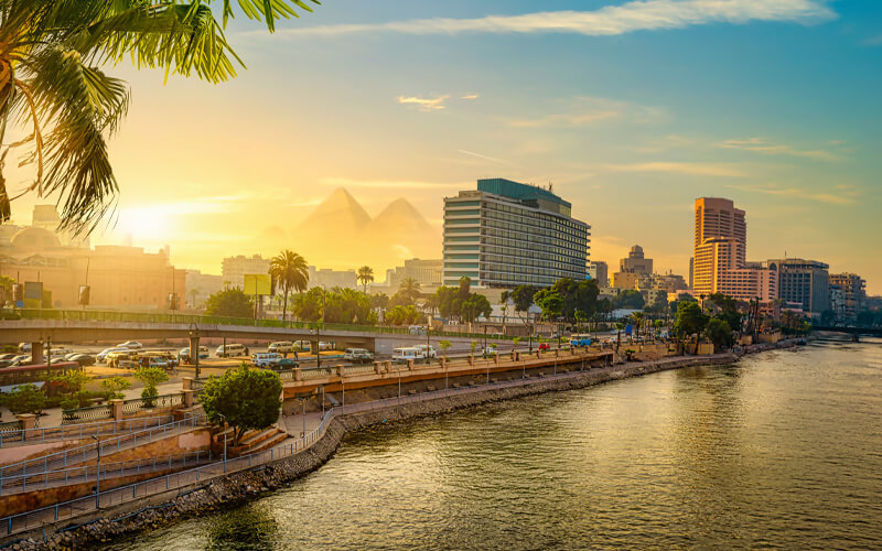
The Nile flows through the Cairo metropolitan region, where bridges, islands, waterfront districts, and river vessels form part of the urban landscape.
A traveler can experience the river in Cairo without booking a multiday cruise.
Short river outings and waterfront walks are common ways to appreciate the Nile’s presence in the Egyptian capital.
The river also helps explain the historic growth of Cairo, Egypt’s capital, which developed near the transition between the narrow Nile Valley and the expanding delta.
North of Cairo, the Nile divides into the principal waterways of the delta before reaching the Mediterranean Sea.
Why Was the Nile River So Important to Ancient Egypt?
The Nile River made large-scale settlement and agriculture possible in one of the world’s driest regions.
For thousands of years, its waters supported crops, transportation, trade, religious activity, and political administration.
The river was not simply a natural landmark beside Ancient Egyptian civilization.
It was a central part of how that civilization functioned.
The Annual Flood and Egyptian Agriculture
Before modern regulation, the Nile experienced a powerful annual flood cycle.
Seasonal rainfall in upstream regions, particularly the Ethiopian Highlands, increased the amount of water entering the main river.
The rising Nile historically spread across parts of Egypt’s floodplain.
As the floodwaters retreated, they left moisture and nutrient-rich sediment on agricultural land.
Farmers used these conditions to cultivate crops and support settlements along the valley.
The regularity of the flood contributed to the development of agricultural planning, land measurement, administration, and taxation.
An unusually low flood could create serious agricultural difficulties.
An excessively high flood could damage settlements and farmland.
The Nile was therefore both a source of prosperity and a natural force requiring careful observation.
For a deeper historical explanation, see why the Nile River was important to Ancient Egypt.
The Nile and the Ancient Egyptian Calendar
Ancient Egyptian agricultural life was closely connected to the river’s seasonal rhythm.
The traditional calendar divided the year into three major seasons:
Akhet: The inundation season, associated with the annual rising of the Nile.
Peret: The emergence or growing season, when land became available for cultivation after the floodwaters withdrew.
Shemu: The harvest season, when crops matured and agricultural produce was gathered.
These seasons demonstrate how strongly ancient timekeeping and agriculture were connected.
The river’s annual rhythm helped structure work, religious celebrations, and state administration.
Actual agricultural practices varied across Egypt and changed over the centuries, but the relationship between the Nile and seasonal planning remained fundamental.
The Nile as an Ancient Transportation Route
The Nile was also one of Ancient Egypt’s most important transport corridors.
Moving heavy materials across desert terrain was difficult.
River transport offered a practical alternative for carrying stone, agricultural produce, manufactured goods, and people.
Boats could travel downstream with the river’s northward current.
Travel upstream could take advantage of prevailing northerly winds when sailing conditions allowed.
The relationship between current and wind made the Nile a particularly valuable transportation route.
Ancient Egyptians developed different types of boats for fishing, trade, ceremonial use, and official journeys.
River travel helped connect distant settlements and major political centers.
It also supported the movement of construction materials used in temples, monuments, and royal projects.
The Nile in Ancient Egyptian Religion
The Nile was closely connected with Egyptian ideas about fertility, renewal, and divine order.
One important figure was Hapi, a deity associated with the Nile’s inundation and its life-giving abundance.
Hapi represented the prosperity brought by the annual flood rather than the river as a modern geographical entity.
Ancient Egyptians also connected water, creation, agricultural renewal, and cosmic order in religious texts and ceremonies.
The river’s importance appears in temples, artistic traditions, and religious symbolism.
Exploring Ancient Egyptian culture helps explain how geography influenced beliefs about nature, kingship, and everyday life.
Why Were So Many Ancient Egyptian Cities Built Near the Nile?
Access to fresh water was essential for permanent settlement.
The Nile Valley provided agricultural land, transportation routes, and connections between communities.
These advantages encouraged the development of towns, administrative centers, and major religious sites.
Memphis and Thebes were among the historically significant centers associated with the Nile system.
The river also connected Egypt with Nubia and other regions to the south.
This connection supported trade but also became important in military and political relationships.
Many archaeological sites visited today are located near the Nile because the river shaped where people could live, produce food, and build monumental structures.
How Did the Nile River Change After the Aswan High Dam?
The construction of the Aswan High Dam fundamentally changed the Nile’s water management in Egypt.
The dam was completed in 1970 and helped regulate the river’s seasonal flow, support irrigation, and generate hydroelectric power.
It also created the vast reservoir commonly known as Lake Nasser.
Before the dam, annual flooding played a direct role in renewing agricultural land along parts of the Nile Valley.
After the dam, river flow became much more controlled.
What Is the Aswan High Dam?
The Aswan High Dam is a major engineering structure across the Nile near Aswan.
Its construction was intended to improve flood regulation, store water for dry periods, and support electricity generation.
The project also had significant environmental and social consequences.
The new reservoir submerged extensive areas of historic Nubia and required the relocation of many communities.
The dam also reduced the natural downstream movement of sediment.
This influenced agricultural practices and contributed to environmental changes in the Nile Delta.
Understanding both the benefits and costs provides a more complete picture than describing the dam only as a modern engineering achievement.
Lake Nasser and the Modern Nile
Lake Nasser is the large artificial reservoir formed behind the Aswan High Dam.
It extends through southern Egypt into northern Sudan, where the Sudanese part of the reservoir is commonly called Lake Nubia.
The lake created a different river environment from the natural channel that existed before the dam.
Its expansive water surface, desert surroundings, and remote archaeological landscapes make it distinctive.
Lake Nasser is particularly associated with the temples of Abu Simbel, which were relocated during an international campaign to protect monuments threatened by rising reservoir waters.
A Lake Nasser cruise is not the same as a conventional Nile cruise between Luxor and Aswan.
The two experiences take place in different geographical sections of the river system.
Does the Nile Still Flood Every Year?
The Nile continues to respond to seasonal rainfall across its upstream basin.
However, the traditional annual inundation experienced across much of Egypt’s agricultural floodplain is no longer the normal pattern.
The Aswan High Dam and other water-management structures regulate the downstream flow.
Water levels can still vary, and flooding remains possible under particular conditions.
It would therefore be inaccurate to claim that the dam eliminated every flood risk.
For travelers, the important distinction is that modern cruise operations take place on a managed river rather than under the historical flood cycle described in accounts of Ancient Egypt.
How Old Is the Nile River?
The Nile River may be approximately 30 million years old, according to geological research published in 2019.
That estimate concerns the long-term development and persistence of the river’s drainage system, not the age of its present water or every modern channel.
Earlier interpretations suggested that the Nile’s present northward route might be around six million years old.
The difference reflects changing scientific interpretations of the region’s geological history.
What Does Geological Research Tell Us?
A study published in Nature Geoscience in November 2019 examined the long-term stability of the Nile’s drainage system.
Researchers combined geological observations and geodynamic modeling.
They proposed that deep processes within Earth’s mantle helped maintain the topographical conditions responsible for the Nile’s northward flow.
In their interpretation, the river system may have followed a broadly stable drainage route for approximately 30 million years.
This is a scientific reconstruction rather than an exact birth certificate for the river.
Rivers develop gradually, and their tributaries, valleys, and courses can change through geological time.
Is the Nile Older Than Ancient Egyptian Civilization?
Yes. The Nile’s geological history extends millions of years before the emergence of Ancient Egyptian civilization.
Egyptian civilization developed during the much more recent history of human settlement in the Nile Valley.
The pharaonic state emerged around 3100 BCE, after earlier communities had already occupied parts of the Nile region.
By that time, the river and its surrounding landscapes had been shaped by enormous periods of geological and environmental change.
This difference in timescale is important.
The monuments visible in Egypt today are thousands of years old.
The river system that influenced their construction may be tens of millions of years old.
Has the Nile Always Looked the Same?
No. The Nile’s geography has changed considerably over time.
Changes in climate, sediment movement, erosion, sea level, and regional geology have influenced its channels and delta.
Human activity has also transformed the river.
Irrigation systems, dams, embankments, and modern settlements have altered how water moves through parts of the basin.
The Nile of the pharaohs, the Nile of the nineteenth century, and the Nile seen by travelers today share a long geographical history, but they are not identical landscapes.
How Deep Is the Nile River?
The Nile River does not have one fixed depth.
Depth varies according to location, water level, channel shape, sediment, and river-management conditions.
Some areas contain shallow banks and channels, while others are considerably deeper.
Scientific surveys in Egypt have recorded substantial differences in depth between measured locations.
A study using satellite imagery and field observations, for example, reported measurements ranging from very shallow water to depths exceeding 20 meters within its investigated area.
Those observations should not be treated as a universal depth range for the entire Nile.
Why Does the Nile’s Depth Change?
Several factors influence river depth.
Riverbed shape: Some channels have relatively flat beds, while others contain deeper sections.
Sediment: Deposited sand and silt can change the shape and depth of a channel.
Water regulation: Dams and barrages influence water levels in regulated sections.
Seasonal inflow: Rainfall in upstream regions affects the volume of water entering the system.
Local geography: Islands, bends, banks, and historical cataract areas influence channel conditions.
Consequently, a depth measurement from Cairo cannot automatically describe the river near Luxor or Aswan.
Is the Nile Deep Enough for Cruise Ships?
Yes. The navigable sections used by established Nile cruise operations accommodate vessels designed for their routes.
However, cruise navigation depends on maintained channels, operating conditions, and water levels.
Some sections of the wider Nile system contain obstacles, dams, cataracts, or other geographical features that prevent continuous navigation.
The existence of commercial cruises does not mean the entire river can be traveled by one boat.
Can You Swim in the Nile River?
Swimming in the Nile is generally not recommended for travelers.
Freshwater in regions where schistosomiasis occurs can present a health risk, and the Nile also contains potentially hazardous currents, boat traffic, and local water-quality concerns.
The US Centers for Disease Control and Prevention advises travelers to avoid swimming or wading in potentially contaminated freshwater in areas where schistosomiasis is endemic.
A hotel swimming pool or an established supervised swimming facility is a safer recreational choice.
Travelers should not assume a calm-looking stretch of the Nile is safe for swimming.
What Are Five Fascinating Facts About the Nile River?
The Nile’s geographical importance goes far beyond its length.
These five facts help explain why it has attracted the attention of historians, geographers, travelers, and scientists.
1. The Nile Connects Equatorial Africa With the Mediterranean
Few rivers link such contrasting climatic regions.
The Nile system begins in areas influenced by tropical rainfall and ends on Egypt’s Mediterranean coastline.
Along the way, it passes wetlands, savannas, dry plains, and desert environments.
This unusual geographical span helps explain the variety of landscapes found across the river basin.
2. The White Nile and Blue Nile Have Different Origins
The White Nile is associated with the Great Lakes region and distant headwaters in East Africa.
The Blue Nile originates in Ethiopia.
Their waters join at Khartoum before continuing as the main Nile.
The two systems also differ in their seasonal patterns and hydrological characteristics.
3. The Nile Helped Support One of the World’s Earliest Civilizations
The river provided the water and agricultural conditions needed for sustained settlement in Ancient Egypt.
It also supported transportation, trade, religious traditions, and political administration.
The Nile’s role in Egyptian history is therefore much broader than simply supplying drinking water.
4. The Nile Delta Is a Product of Thousands of Years of River Activity
The Nile Delta developed through the accumulation and redistribution of sediment carried downstream.
Its shape and channels have changed through natural processes and human intervention.
Modern water regulation has also affected sediment delivery and coastal conditions.
5. You Do Not Need to Travel Thousands of Miles to Appreciate the Nile
The complete Nile River is more than 4,000 miles long, but many of its most recognizable Egyptian experiences are concentrated around Cairo, Luxor, and Aswan.
A short sail near Aswan, a river crossing in Luxor, or a waterfront evening in Cairo can provide a meaningful introduction to the river.
The best Nile experience depends more on a traveler’s interests than on the distance covered.
What Wildlife Lives in and Around the Nile River?
The Nile supports different ecosystems across its extensive basin.
Its wetlands, lakes, banks, and surrounding habitats are associated with fish, birds, reptiles, mammals, and aquatic vegetation.
However, wildlife populations differ substantially by location.
A traveler should not expect the same animals around Cairo that might be found in more tropical parts of the Nile system.
Are There Crocodiles in the Nile?
Nile crocodiles are native to parts of the Nile Basin.
Historically, crocodiles were associated with Egyptian religious traditions and appeared in representations of the god Sobek.
Today, Nile crocodiles are not a routine sight along the main tourist cruise route between Luxor and Aswan.
They are associated with habitats farther south, including Lake Nasser.
Visitors should avoid approaching wildlife or entering waters where crocodiles may occur.
Birds Along the Nile
The Nile and its surrounding agricultural and wetland environments provide habitat for numerous bird species.
Depending on the season and location, visitors may observe herons, egrets, kingfishers, and other water-associated birds.
Birdwatching opportunities differ between urban riverfronts, islands near Aswan, agricultural waterways, and the delta.
Morning and late afternoon can be particularly rewarding times to observe activity along quieter riverbanks.
Papyrus and River Vegetation
Papyrus is strongly associated with Ancient Egyptian culture.
The plant historically grew in wetlands and provided material used for writing surfaces, baskets, and other products.
Ancient Egyptian texts and illustrations preserve evidence of its cultural importance.
Today, travelers should not assume papyrus grows naturally along every section of the Nile.
The river’s modern vegetation reflects environmental conditions, agriculture, and centuries of human alteration.
What Can Travelers See Along the Nile River in Egypt?
The most practical way to experience the Nile depends on how much time a traveler has and which parts of Egyptian history interest them.
Some visitors enjoy short boat trips.
Others prefer archaeological excursions combined with river travel.
The main sightseeing areas are Cairo, Luxor, Aswan, and the temple sites between Luxor and Aswan.
Cairo: Experience the Nile Without a Cruise
Cairo offers one of the easiest ways to see the river during a short visit to Egypt.
The Nile runs through the metropolitan area and is visible from numerous bridges and riverfront locations.
A traveler can arrange a short boat ride, enjoy an evening along the waterfront, or spend time observing daily activity around the river.
Traditional feluccas operate in suitable areas, alongside other types of river vessels.
The atmosphere differs considerably from Upper Egypt.
Cairo’s Nile is urban, with buildings, bridges, traffic, and city lights forming much of the surrounding landscape.
For visitors whose main interests are the pyramids and museums, a short Nile outing can fit naturally into a Cairo itinerary.
It does not require a multiday cruise or extensive travel south.
Luxor: Ancient Thebes on Both Banks
Luxor is especially rewarding for travelers who want to understand how the Nile influenced Ancient Egyptian religious geography.
The river separates the principal eastern temple areas from the western archaeological landscape.
Visitors can explore Karnak and Luxor Temple on the east bank, then cross to the west bank to visit royal tombs and mortuary temples.
A river crossing adds useful geographical context.
It demonstrates that many of the monuments were part of a connected ancient landscape rather than isolated attractions.
Luxor is also a major departure and arrival point for Nile cruise vessels.
Travelers interested in the city can explore Luxor and its archaeological attractions.
Edfu: A Temple Connected to River Travel
The Temple of Edfu is one of the major archaeological stops on many Nile cruise itineraries.
Dedicated to Horus, the temple preserves a substantial amount of its ancient architectural structure.
River passengers typically visit the temple during a scheduled shore excursion.
The experience demonstrates how Nile navigation and temple visits remain connected in modern Egyptian tourism.
Travelers should check their specific itinerary rather than assume every vessel stops at Edfu.
Kom Ombo: A Temple Beside the Nile
The Temple of Kom Ombo occupies a prominent position near the river.
The temple is unusual for its dual dedication to Sobek and Horus the Elder.
Its relationship with Sobek also makes it relevant to the Nile’s religious symbolism.
The riverside setting helps visitors visualize how temples, settlements, and transport routes interacted.
Kom Ombo is commonly included in Nile cruise programs between Luxor and Aswan.
Aswan: Islands, Feluccas, and Nubian Landscapes
Aswan provides a quieter river atmosphere than central Cairo.
Traditional sailing boats, islands, and granite formations create distinctive scenery.
Visitors can enjoy shorter excursions rather than committing to a multiday journey.
The city is also a convenient base for exploring archaeological sites associated with Nubia and southern Ancient Egypt.
The Temple of Philae is one of the most important nearby attractions.
The temple complex was relocated to Agilkia Island as part of the international effort to protect Nubian monuments from rising water.
A visit involves a boat transfer, creating a direct connection between the archaeological experience and the region’s waterways.
Abu Simbel and Lake Nasser
Abu Simbel lies south of Aswan beside Lake Nasser.
Its monumental rock-cut temples were originally constructed under Ramesses II.
The temples were relocated to higher ground during the twentieth century to protect them from the waters of the new reservoir.
The Abu Simbel temples are often visited by road or air from Aswan, subject to available transport arrangements.
Lake Nasser cruise itineraries may also include the site.
Travelers should distinguish this experience from the conventional Luxor–Aswan Nile cruise route, which does not sail through the reservoir.
Can You Cruise the Entire Length of the Nile River?
No. A standard tourist cruise does not travel the Nile’s complete 6,650-kilometer length.
The Nile crosses multiple countries and contains geographical and infrastructure barriers that make continuous navigation impractical.
Wetlands, cataracts, dams, changes in navigability, and international borders all influence river transport.
Tourist cruises in Egypt generally operate on selected navigable sections.
What Is the Most Popular Nile Cruise Route?
The most established Egyptian Nile cruise route connects Luxor and Aswan.
Trips commonly take three or four nights, although longer and round-trip options are also available.
Popular archaeological excursions may include Edfu, Kom Ombo, Luxor’s temples and tombs, and attractions around Aswan.
Travelers can compare Egypt Nile cruise experiences to understand the different styles of river travel.
Nile Cruise Options Compared
| Nile Experience | Typical Time | Best For | Main Limitation |
|---|---|---|---|
| Cairo river outing | About 1–2 hours | Short stays and city visitors | Limited archaeological sightseeing |
| Aswan felucca outing | About 1–3 hours | Scenery and traditional sailing | Wind and weather affect the experience |
| Luxor–Aswan cruise | Commonly 3–4 nights | First-time visitors and temple sightseeing | Fixed schedules and group excursions |
| Extended Nile cruise | Approximately 7 nights or longer | Travelers wanting additional river time | Availability and routes vary |
| Dahabiya cruise | Often several nights | Small-group, quieter experiences | Schedules and boarding points vary |
| Lake Nasser cruise | Commonly several nights | Nubian monuments and remote scenery | Separate from the Luxor–Aswan route |
Durations are indicative rather than guaranteed schedules for 2027.
What Is the Difference Between a Nile Cruise Ship and a Dahabiya?
A conventional Nile cruise ship is a motorized vessel with guest cabins, dining facilities, and organized sightseeing.
Many operate scheduled itineraries between Luxor and Aswan.
A dahabiya is generally a smaller traditional-style sailing vessel, often assisted by a tug or engine when necessary.
It may offer a more intimate experience and a different pace of travel.
Travelers considering a smaller vessel can explore dahabiya boats in Egypt.
The ideal option depends on preferred comfort, group size, schedule flexibility, and sightseeing priorities.
What Is a Felucca?
A felucca is a traditional sailing boat widely associated with the Nile.
Feluccas are often used for short scenic outings, particularly around Aswan and Cairo.
Unlike large river cruise vessels, they generally provide a simpler sailing experience.
A felucca outing may be suitable for travelers who want to enjoy the scenery without booking overnight accommodation aboard a vessel.
However, visitors should confirm seating, shade, safety equipment, trip duration, and whether the outing depends on wind conditions.
Does a Nile Cruise Travel North or South?
The Nile flows north.
A vessel traveling from Aswan toward Luxor generally travels downstream.
A vessel traveling from Luxor toward Aswan generally travels upstream.
Modern cruise vessels can navigate in either direction where operating conditions permit.
Sailing direction alone does not determine which itinerary is better.
The more important considerations are excursion schedules, total nights, transport connections, and where a traveler needs to finish the trip.
For a more detailed breakdown, consult a Nile cruise itinerary guide.
When Is the Best Time to See the Nile River in Egypt?
October through April is generally the most comfortable period for sightseeing along the Nile, particularly in Upper Egypt.
Temperatures are usually milder than during the hottest summer months.
However, the best time depends on the traveler’s tolerance for heat, preferred activities, and itinerary.
Nile River Travel by Season
| Period | Typical Conditions | Travel Considerations |
|---|---|---|
| December–February | Mild days and cooler evenings | Popular for sightseeing; bring layers |
| March–April | Generally warming conditions | Good for excursions; occasional dusty weather |
| May–June | Increasing heat, especially in Upper Egypt | Plan outdoor activities earlier |
| July–August | Very hot in Luxor and Aswan | Midday archaeological visits can be demanding |
| September | Hot weather gradually easing | Heat remains an important consideration |
| October–November | Generally pleasant for many visitors | Attractive period for cruises and sightseeing |
This is a seasonal overview, not a forecast for individual dates in 2027.
Travelers can use the Egypt weather by month guide to compare conditions across the year.
Is Summer a Bad Time for a Nile Cruise?
Not necessarily, but summer requires realistic expectations.
Luxor and Aswan can experience intense daytime heat.
Temples and archaeological sites often include large exposed areas with limited shade.
Travelers who prefer cooler walking conditions may find winter more comfortable.
Those visiting during summer should prioritize early excursions, sufficient drinking water, sun protection, and air-conditioned rest periods.
It is also important to check whether a particular cruise operates on the intended dates.
What Should You Pack for Nile River Travel?
Clothing should reflect the season and the planned activities.
Lightweight, breathable fabrics are useful during warm conditions.
Comfortable walking shoes are important for temple visits and excursions over uneven ground.
Sun protection is valuable throughout much of the year.
Winter evenings can be cooler than visitors expect, especially when spending time on an open deck.
For practical preparation, use the Nile cruise packing guide.
How Much Time Do You Need to Experience the Nile in Egypt?
The Nile can be enjoyed in a few hours, but exploring its historical significance usually requires several days.
The best duration depends on whether the goal is a scenic boat ride, archaeological sightseeing, or a longer river-based holiday.
If You Have One Day
Focus on one city rather than attempting to cover multiple Nile regions.
In Cairo, combine a short river outing with sightseeing already planned in the capital.
In Aswan, consider a felucca excursion, an island visit, or a visit to Philae.
In Luxor, prioritize the archaeological sites and use a river crossing to appreciate the city’s east–west geography.
A one-day outing is enough to experience the river locally but not to explore its wider Egyptian route.
If You Have Two or Three Days
Stay in Luxor or Aswan and include several nearby sites.
Luxor works particularly well for travelers interested in temples, tombs, and the relationship between the Nile and Ancient Egyptian religious life.
Aswan may appeal to travelers interested in island scenery, traditional sailing, and Nubian history.
Trying to include Cairo, Luxor, and Aswan in only two or three days usually results in too much transport and too little time at each location.
If You Have Four or Five Days
A short Nile cruise between Luxor and Aswan becomes a practical option.
This allows travelers to combine river scenery with scheduled excursions.
Many programs cover major temples and archaeological sites along the route.
Actual departure and arrival arrangements vary, so cruise nights should not be confused with full days of sightseeing.
An itinerary advertised as four days may include partial arrival and departure days.
If You Have Seven to Ten Days
A longer Egypt holiday can combine Cairo, Luxor, Aswan, and a Nile cruise.
This is often a more balanced choice for a first visit.
Cairo provides access to the Giza Plateau and major museums, while Luxor and Aswan introduce the monuments and landscapes of Upper Egypt.
Travelers can compare Egypt itineraries to choose a route suited to their available time.
The objective should not be to cover the Nile’s greatest possible distance.
It should be to experience the sections offering the most value for the trip.
How to Plan a Nile-Focused Egypt Itinerary for 2027
The most efficient way to organize a Nile-focused trip is to choose the desired experiences first, then arrange transport around them.
Attempting to follow the river geographically from north to south is not always the most practical approach.
For example, many travelers arrive in Cairo and then use domestic transport to reach Luxor or Aswan.
Others begin their Egypt journey in Upper Egypt.
Suggested Seven-Day Egypt and Nile Itinerary
| Day | Location | Main Experience |
|---|---|---|
| Day 1 | Cairo | Arrival and short Nile waterfront experience |
| Day 2 | Cairo and Giza | Pyramids, museums, or selected cultural sites |
| Day 3 | Luxor | Travel to Luxor and visit east-bank temples |
| Day 4 | Luxor | West-bank archaeological excursions and cruise embarkation |
| Day 5 | Nile cruise | Sailing and scheduled temple excursions |
| Day 6 | Nile cruise / Aswan | Additional river sightseeing and arrival arrangements |
| Day 7 | Aswan | Philae or a shorter river experience before onward travel |
This is an illustrative route rather than a confirmed cruise schedule.
A suitable sailing may require more nights or a different sequence of attractions.
Why Cairo, Luxor, and Aswan Work Well Together
These three cities introduce different aspects of the Nile.
Cairo reveals the river’s role in modern urban Egypt and its relationship with the northern valley and delta.
Luxor demonstrates the connection between the Nile, Ancient Egyptian religion, royal burial traditions, and monumental architecture.
Aswan provides distinctive southern scenery and insight into Egypt’s historical relationship with Nubia.
Together, they create a more complete impression than visiting only one section.
Should You Include Lake Nasser?
Lake Nasser is worth considering when Nubian monuments and quieter desert-water landscapes are central interests.
However, adding it requires separate planning.
Travelers with limited time should generally prioritize the main Nile Valley sites before including more remote experiences.
Those with longer itineraries may wish to combine Aswan with Abu Simbel or a dedicated Lake Nasser cruise.
The right decision depends on available days, transport arrangements, and the archaeological sites that matter most.
Should You Book a Private Egypt Itinerary?
A private itinerary can be useful for travelers who want more control over sightseeing durations, transport, and hotel arrangements.
This may be particularly helpful for families, older travelers, visitors with mobility considerations, and travelers combining multiple regions.
However, private arrangements are not necessary for everyone.
A scheduled Nile cruise may provide enough structure for travelers who prefer a straightforward, organized experience.
Egypt Time Travel offers Egypt tours with Nile cruises for visitors who want to combine the river with major archaeological sites and other parts of the country.
Common Misconceptions About the Nile River
Several widely repeated statements about the Nile contain an element of truth but omit important geographical details.
Understanding these distinctions helps travelers interpret information more accurately.
Misconception 1: The Nile River Is Entirely in Egypt
The Nile’s downstream course passes through Egypt, but its wider system extends across northeastern and East Africa.
Egypt is one of several countries connected to the river.
The Nile’s major tributaries and headwaters are located outside Egypt.
Misconception 2: The Nile Begins at One Clearly Identifiable Point
Lake Victoria is an important source lake, but the White Nile system includes more distant tributaries.
The Blue Nile begins separately in Ethiopia.
Determining the ultimate source of the longest Nile route remains a geographical question involving several possible headwaters.
Misconception 3: The Nile Is Exactly 6,650 Kilometers Long
The figure of 6,650 kilometers is a widely used approximation.
Other established sources give about 6,695 kilometers.
The differences should be explained rather than ignored.
Misconception 4: The Nile Is the World’s Largest River
The Nile is traditionally considered the longest river.
It is not the largest river by water discharge.
That distinction belongs to the Amazon.
Misconception 5: A Nile Cruise Travels Most of the River
Conventional Nile cruises cover only selected sections, usually between Luxor and Aswan.
These routes are popular because they connect important archaeological sites and navigable waterways.
They are not expeditions along the river’s entire African course.
Misconception 6: Every Stretch of the Nile Looks the Same
The river passes through very different environments.
The Nile near Aswan looks different from the Nile in Cairo, and both differ from the wetlands of South Sudan or the headwaters of East Africa.
This diversity is central to understanding the river’s geographical importance.
Misconception 7: The Nile No Longer Changes Because It Has Dams
Dams regulate major parts of the system, but they do not stop rainfall variation, sediment processes, or changes in water levels.
The Nile remains an active river influenced by natural conditions and human decisions.
Frequently Asked Questions About the Nile River
How Long Is the River Nile in Africa?
The River Nile is approximately 6,650 kilometers (4,130 miles) long, using the commonly quoted measurement. Alternative estimates reach approximately 6,695 kilometers (4,160 miles). Its connected system extends across northeastern and East Africa, with the main Nile flowing north through Sudan and Egypt toward the Mediterranean Sea.
How Long Is the Nile River From Egypt?
The Nile’s Egyptian section is approximately 1,532 kilometers (952 miles) long according to an Egyptian government geographical estimate. This measures the river within Egypt rather than its full African journey. The precise figure can vary depending on which channels and endpoints are included.
Where Does the Nile River Begin?
The Nile’s longest headwater system is associated with the White Nile and the East African Great Lakes region. Lake Victoria is the most widely recognized source lake, but the Kagera River system extends farther upstream into Rwanda and Burundi. The Blue Nile, another major tributary, originates in Ethiopia.
Where Does the Nile River End?
The Nile ends in the Mediterranean Sea along Egypt’s northern coastline. Before reaching the sea, the river divides into the principal Rosetta and Damietta branches of the Nile Delta. These channels form the main modern outlets of the river.
Is the Nile River Longer Than the Amazon?
The Nile is traditionally recognized as longer than the Amazon, although the ranking is debated. Some measurements place the Nile at approximately 6,695 kilometers, while alternative measurements of the Amazon may produce a greater length. The result depends on how each river’s source and mouth are defined.
How Wide Is the Nile River?
The Nile’s width varies considerably by location. Some channels are relatively narrow, while other sections are much wider. Lake Nasser and other water bodies connected to the Nile should not be confused with the ordinary width of its natural river channel. A reliable width measurement must specify the location being measured.
Why Is the Nile River Famous?
The Nile is famous for its extraordinary length, importance to Ancient Egyptian civilization, and continued role in supporting communities across Africa. Its waters historically enabled agriculture, transportation, and settlement in the Egyptian desert. Today, the river remains an important geographical, cultural, environmental, and economic feature.
Is the Nile River Freshwater or Saltwater?
The Nile is principally a freshwater river. Its waters originate from rainfall and connected freshwater systems across Africa. Near the Mediterranean, however, river and seawater interact in coastal and estuarine environments. The river’s freshwater character should not be taken to mean that untreated Nile water is safe to drink.
Can Tourists Travel Along the Nile River?
Yes. Tourists can experience the Nile through short boat outings, felucca sailing, dahabiya journeys, and scheduled river cruises. The most popular Egyptian multiday cruise section is between Luxor and Aswan. Travel along the river’s entire African length is not offered as a conventional continuous tourist cruise.
What Is the Best Place to See the Nile River in Egypt?
Aswan is an excellent choice for scenery, islands, granite formations, and traditional sailing. Luxor is particularly appealing for travelers interested in Ancient Egyptian temples and royal tombs. Cairo provides convenient river experiences for short-stay visitors. The best location depends on whether scenery, history, or accessibility is the priority.
Is It Safe to Drink Water Directly From the Nile?
No. Travelers should not drink untreated water directly from the Nile. Natural freshwater can contain microorganisms, pollutants, and other contaminants. Use appropriately treated drinking water and follow reliable local health guidance. Being aboard a cruise vessel does not make untreated river water safe for consumption.
Is the Nile River Worth Visiting in 2027?
Yes, particularly for travelers interested in Egyptian history, landscapes, or river travel. A Nile experience can be as short as a boat ride in Cairo or Aswan, or as extensive as a cruise with visits to major archaeological sites. Travelers should confirm their chosen operator’s 2027 schedules, transport arrangements, and excursion inclusions before booking.
Conclusion: Understanding the Nile Beyond Its Length
So, how long is the Nile River? The most commonly used answer is approximately 6,650 kilometers (4,130 miles), although some established geographical sources report around 6,695 kilometers (4,160 miles).
The river begins within a complex network of African headwaters, receives major contributions from the White Nile and Blue Nile, flows north through Sudan and Egypt, and ends in the Mediterranean Sea.
Its extraordinary length is only one part of its importance.
The Nile helped shape the development of Ancient Egyptian civilization, continues to support communities across a vast river basin, and provides some of Egypt’s most meaningful historical and cultural travel experiences.
For visitors planning a journey in 2027, exploring the Nile around Luxor and Aswan offers an opportunity to connect the river’s geography with the temples, settlements, and landscapes it has influenced for thousands of years.
The most rewarding experience is not necessarily the longest journey. It is the one that helps you understand why the Nile remains central to Egypt’s identity.
