
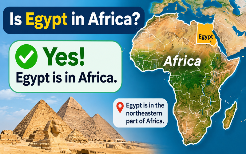
Quick Answer: Is Egypt in Africa?
Yes, Egypt is in Africa. It is located in the northeastern corner of the African continent, with approximately 94% of its territory in Africa and about 6% in Asia through the Sinai Peninsula. Egypt is therefore a transcontinental country. Its capital, Cairo, and famous attractions such as the Pyramids of Giza, Luxor, and Aswan are all geographically in Africa.
Egypt occupies an unusual position on the world map. It is unmistakably African, yet one part of the country extends into Asia, and its history and culture connect it closely with the Middle East and the Mediterranean.
This explains why Egypt can appear under several geographical descriptions without those descriptions necessarily contradicting one another.
The distinction also reveals something interesting for travelers: the Pyramids of Giza are in Africa, while the popular Red Sea destination of Sharm El-Sheikh is in Asia. Both destinations are in the same country.
Understanding Egypt’s location on the map makes it easier to appreciate its geography, history, neighboring countries, famous landmarks, and the different regions you may visit during a trip in 2027.
Where Is Egypt Located in Africa?
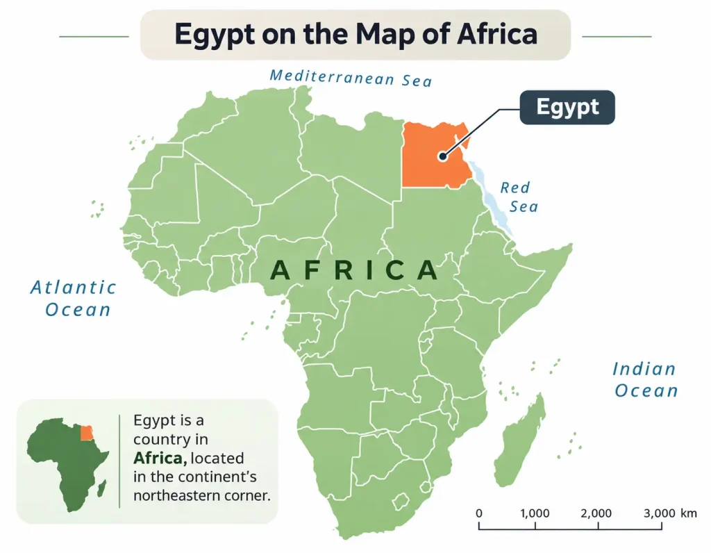
Egypt is located in Northeastern Africa, at the northern edge of the continent, where Africa approaches the Arabian Peninsula and Southwest Asia.
Its position is easy to recognize on a world map. Egypt occupies the northeastern corner of the African mainland, bordered by the Mediterranean Sea to the north and the Red Sea to the east.
Unlike many landlocked African countries, Egypt has access to two major seas. This geographical advantage has shaped its trading relationships, settlements, transportation networks, and connections with neighboring civilizations for thousands of years.
Egypt’s Exact Geographical Location
Egypt lies approximately between 22° and 32° north latitude and 24° and 37° east longitude.
Its approximate central geographical coordinates are:
-
Latitude: 27° North
-
Longitude: 30° East
-
Continent: Primarily Africa, with territory in Asia
-
African Region: Northeastern Africa
-
Capital: Cairo
-
Official Name: Arab Republic of Egypt
-
Total Area: Approximately 1,002,000 square kilometers
-
Official Language: Arabic
-
Currency: Egyptian Pound (EGP)
The country stretches from the Mediterranean coastline in the north to its southern border with Sudan.
Egypt’s landscape includes the Nile Valley, the Nile Delta, extensive desert regions, mountains, and coastlines along the Mediterranean and Red seas.
The famous Nile River runs through Egypt from south to north, providing water and fertile land in an otherwise predominantly arid environment.
This explains why many of the country’s most important cities developed along the river rather than across its enormous deserts.
Which Countries Border Egypt?
Egypt has land borders with three neighboring countries or territories: Libya, Sudan, Israel, and the Gaza Strip of Palestine.
|
Direction |
Neighboring country or geographical feature |
|---|---|
|
North |
Mediterranean Sea |
|
West |
Libya |
|
South |
Sudan |
|
Northeast |
Israel and the Gaza Strip |
|
East |
Gulf of Aqaba and Red Sea |
|
Northwest across the Mediterranean |
Southern Europe |
|
East across the Red Sea |
Arabian Peninsula |
Egypt does not share a land border with Saudi Arabia or Jordan, although both are geographically close.
Saudi Arabia lies across the Red Sea, while Jordan is across the Gulf of Aqaba.
This proximity helps explain why Egypt is often discussed alongside Middle Eastern countries, even though most Egyptian territory is in Africa.
Is Egypt in North Africa or East Africa?
Egypt is most commonly classified as part of North Africa, specifically its northeastern section.
The distinction is geographical rather than contradictory.
North Africa refers to the northern part of the continent, generally including countries such as Egypt, Libya, Tunisia, Algeria, and Morocco.
Northeast Africa describes Egypt’s more precise position within that larger region.
Egypt also has important historical and geographical connections with northeastern African countries farther south, particularly Sudan.
The Nile links Egypt to a wider river system extending across eastern and northeastern Africa.
For tourism and general geography, North Africa is the clearest regional classification.
For a more precise description, Northeast Africa is equally appropriate.
Is Egypt in Africa or Asia?
Egypt is in both Africa and Asia, but the overwhelming majority of its territory is African.
Countries whose territory extends into more than one continent are called transcontinental countries.
Egypt is one of the clearest examples because a relatively small, recognizable peninsula forms its Asian territory, while the main part of the country occupies northeastern Africa.
How Much of Egypt Is in Africa?
Approximately 94% of Egypt’s territory is in Africa, while around 6% lies in Asia.
The Asian portion is the Sinai Peninsula, which covers approximately 61,000 square kilometers.
These are rounded geographical figures, not exact cadastral measurements.
|
Geographical characteristic |
African Egypt |
Asian Egypt |
|---|---|---|
|
Approximate share of territory |
94% |
6% |
|
Main geographical area |
Nile Valley, Nile Delta, deserts and mainland coasts |
Sinai Peninsula |
|
Major cities and destinations |
Cairo, Giza, Alexandria, Luxor, Aswan, Hurghada |
Sharm El-Sheikh, Dahab, Taba, Nuweiba |
|
Important landscapes |
Nile River, Sahara, Mediterranean coastline, Eastern Desert |
Sinai Mountains, Gulf of Aqaba coastline, desert valleys |
|
Famous attractions |
Pyramids of Giza, Karnak Temple, Abu Simbel |
Saint Catherine’s Monastery, Mount Sinai, Ras Mohammed |
|
Geographic relationship |
Main African territory |
Asian extension of Egypt |
Although the Asian section is much smaller, it contains internationally known destinations, natural landscapes, and important religious heritage.
The Sinai Peninsula is particularly significant for its mountainous environment, Red Sea marine ecosystems, and historical position between Africa and Asia.
Why Is the Sinai Peninsula Considered Part of Asia?
The Sinai Peninsula lies east of the Suez Canal, the conventional geographical dividing line between Africa and Asia in Egypt.
Sinai is a roughly triangular landmass.
Its boundaries are defined by:
-
The Mediterranean Sea to the north.
-
The Gulf of Suez and Suez Canal to the west.
-
The Gulf of Aqaba and the northeastern land border to the east.
-
The southern tip of the peninsula near Ras Mohammed.
The peninsula is politically part of Egypt.
Geographically, however, it belongs to Asia.
That distinction does not make Sinai a separate country or require travelers to think of it as an independent destination.
Someone visiting the Sinai Peninsula is still traveling within Egypt.
Does Egypt Have Two Continents?
Yes. Egypt is a single sovereign country with territory in two continents.
This is different from saying that Egypt belongs to two separate countries or governments.
Cairo is the capital of the entire country, including the Asian Sinai Peninsula.
Egypt has one national government, one national currency, and one internationally recognized state identity.
The continental distinction is primarily geographical.
It becomes useful when discussing maps, physical geography, regional history, or the location of particular Egyptian destinations.
For example, someone visiting Cairo and Sharm El-Sheikh can experience both African and Asian landscapes without traveling to another country.
Is Egypt Similar to Turkey?
Egypt and Turkey are both transcontinental countries, but their geography differs.
Egypt is predominantly African, with its Asian extension in Sinai.
Turkey is predominantly Asian, with a smaller European territory in Eastern Thrace.
Both countries occupy strategically important positions between major geographical regions.
Their locations have influenced trade, migration, politics, and cultural exchange over centuries.
For travelers, Egypt’s Africa–Asia distinction is especially visible in the transition between the Nile Valley and Sinai.

Where Is Egypt on the Map of Africa?
To find Egypt on a map of Africa, look at the continent’s northeastern corner, directly south of the Mediterranean Sea.
Egypt appears to the east of Libya, north of Sudan, and west of the northern Red Sea.
The Sinai Peninsula projects northeast from the main African territory toward the eastern Mediterranean and Southwest Asia.
Egypt’s location becomes easier to understand when you identify a few geographical landmarks in sequence.
How to Find Egypt on a World Map
Follow these steps:
-
Locate the continent of Africa, south of Europe.
-
Look along Africa’s northern Mediterranean coastline.
-
Move east toward the continent’s northeastern corner.
-
Find Libya and follow its eastern border.
-
Identify Egypt, which lies between Libya and the Red Sea.
-
Look for the Nile River running through Egypt toward the Mediterranean.
-
Find the triangular Sinai Peninsula in the country’s northeast.
The most important reference point is the northeastern edge of Africa.
Egypt is not located in central, western, or southern Africa.
It is a North African country positioned at the meeting point of the African mainland and the Asian landmass.
What Should an Accurate Map of Egypt Show?
A useful geographical map should identify more than the country’s outline.
Look for these features:
|
Map feature |
What it tells you |
|---|---|
|
African mainland |
Where most of Egypt’s territory lies |
|
Sinai Peninsula |
Which section extends into Asia |
|
Suez Canal |
The conventional Africa–Asia dividing line |
|
Nile River |
The main river corridor connecting southern and northern Egypt |
|
Nile Delta |
The fertile northern region where the river reaches the Mediterranean |
|
Mediterranean Sea |
Egypt’s northern coastline |
|
Red Sea |
Egypt’s eastern maritime region |
|
Cairo and Giza |
The location of the capital and pyramids |
|
Luxor and Aswan |
Major historical destinations farther south |
|
Sharm El-Sheikh and Dahab |
Popular destinations on the Asian Sinai Peninsula |
A standard political map may not label the continental boundary clearly.
Some maps color Egypt as one unit because political maps emphasize national borders rather than continental divisions.
Others show Sinai alongside Asia to emphasize its physical geographical location.
Both approaches can be valid if the map’s purpose is understood.
Where Is Egypt Located Compared With Europe?
Egypt lies south of Europe, across the Mediterranean Sea.
It is relatively close to southern European countries, particularly Greece, Cyprus, Italy, and Malta, although not all are equally close to the Egyptian coast.
This proximity has contributed to longstanding connections between Egypt and Mediterranean civilizations.
Modern travelers often find direct or connecting flights between major European cities and Egyptian destinations.
However, geographical proximity does not make Egypt a European country.
Egypt is neither part of the European continent nor a member of the European Union.
Its European connections are historical, geographical, cultural, and commercial.
Where Is Egypt Compared With the Arabian Peninsula?
Egypt lies west of the Arabian Peninsula.
The Red Sea separates much of the African mainland from Arabia.
The Sinai Peninsula occupies an important position between northeastern Africa and the western edge of Southwest Asia.
Jordan and Saudi Arabia are close to the Gulf of Aqaba, while Egypt’s northeastern land borders connect Sinai with the area of Israel and Gaza.
This geography helps explain why Egypt features prominently in discussions about North Africa, the Middle East, Mediterranean history, and Red Sea tourism.
Is Egypt in Africa or the Middle East?
Egypt is geographically part of Africa and is also widely considered part of the Middle East.
These descriptions refer to different ways of grouping countries.
Africa is a continent. The Middle East is a regional term covering countries linked by geography, history, politics, culture, and international relations.
Therefore, describing Egypt as Middle Eastern does not mean that it stops being African.
Africa vs. the Middle East: What’s the Difference?
|
Classification |
What it means |
Does it include Egypt? |
|---|---|---|
|
Africa |
A geographical continent |
Yes |
|
North Africa |
The northern geographical region of Africa |
Yes |
|
Northeast Africa |
The northeastern part of the African continent |
Yes |
|
Asia |
A geographical continent |
Partly, through Sinai |
|
Middle East |
A broad geopolitical and cultural region |
Yes, in common usage |
|
MENA |
Middle East and North Africa |
Yes |
|
Arab World |
Countries and societies connected by Arabic language and Arab identity |
Yes |
|
Mediterranean region |
Countries around the Mediterranean Sea |
Yes |
|
Europe |
A separate geographical continent |
No |
These classifications serve different purposes.
When answering “What continent is Egypt in?” the best short answer is Africa, with a smaller territory in Asia.
When discussing politics or international relations, the term Middle East may also be appropriate.
When discussing shared language and cultural connections, Egypt is a major part of the Arab world.
Why Is Egypt Called a Middle Eastern Country?
Egypt’s connection with the Middle East developed through geography, history, trade, language, religion, and political relationships.
The Sinai Peninsula provides a land connection with Southwest Asia.
Egyptian ports and trade routes have connected the Nile Valley with the eastern Mediterranean and Arabian Peninsula for centuries.
Arabic is Egypt’s official language, and Egyptian society shares important historical and cultural connections with other Arabic-speaking countries.
Modern Egyptian institutions and regional relationships also place Egypt within many Middle Eastern political and economic discussions.
These connections explain the label, but they do not replace Egypt’s African geography.
Is Egypt an Arab Country or an African Country?
Egypt is both an Arab country and an African country.
The terms refer to different forms of identity.
African describes Egypt’s continental location and its connections with African history, geography, and institutions.
Arab describes an important dimension of its language, cultural identity, and historical relationships.
The country is officially named the Arab Republic of Egypt.
Arabic is its official language, and the everyday spoken variety is commonly called Egyptian Arabic.
Egypt also contains diverse regional identities and traditions.
Nubian communities in southern Egypt, Bedouin communities in Sinai and desert regions, and other local communities contribute to the country’s cultural diversity.
Egyptian identity cannot be reduced to a single geographical or cultural label.
Is Egypt Part of the African Union?
Yes. Egypt is a member of the African Union.
The African Union is a continental organization bringing together African countries for cooperation on political, economic, security, and development issues.
Egypt participated in the Organization of African Unity, the African Union’s predecessor, and remains an important member of the modern continental organization.
Its membership is one contemporary example of Egypt’s institutional connections with Africa.
Is Egypt in Europe or Africa?
Egypt is in Africa, not Europe, although its Sinai territory is geographically in Asia.
Confusion sometimes arises because Egypt has extensive Mediterranean connections and a long history of interaction with European civilizations.
The ancient Greeks and Romans had substantial relationships with Egypt, and Alexandria became an important center of scholarship and Mediterranean culture.
Those historical relationships do not change continental geography.
Cairo, Alexandria, the Nile Valley, and the pyramids all remain geographically African.
Is Cairo, Egypt, in Africa?
Yes. Cairo is in Africa.
It is located in northeastern Africa, close to the southern end of the Nile Delta.
Cairo is Egypt’s capital and one of the continent’s major metropolitan centers.
The city developed along the Nile, while the wider metropolitan area extends across both sides of the river.
For travelers arriving in Egypt, Cairo is often their first destination and the starting point for visiting the Pyramids of Giza and other major attractions.
Where Is Cairo on the Map of Egypt?
Cairo lies in northern Egypt, inland from the Mediterranean Sea.
It is situated near the point where the Nile Valley opens into the broader Nile Delta.
On a map, locate the Nile River and follow it northward toward the Mediterranean.
Cairo appears just south of the main delta region.
The city is considerably farther north than Luxor and Aswan.
Its geographical position makes it a convenient starting point for exploring northern Egypt and connecting to other regions.
For a more detailed explanation of the city’s geography and history, explore Cairo, the capital of Egypt.
Are the Pyramids of Giza in Africa?
Yes. The Pyramids of Giza are located in Africa.
They stand on the Giza Plateau, west of the Nile, near Cairo.
The archaeological complex includes the Great Pyramid of Khufu, the Pyramid of Khafre, the Pyramid of Menkaure, and the Great Sphinx.
These monuments are among the most recognizable surviving achievements of ancient Egyptian civilization.
Their location on the African mainland is not geographically disputed.
Visitors exploring the Giza Necropolis are visiting one of Africa’s most significant archaeological landscapes.
Is Giza a Separate Country or City?
Giza is not a separate country.
It is an Egyptian city and governorate forming part of the wider Cairo metropolitan area.
The Pyramids of Giza are located in Giza Governorate, rather than within Cairo Governorate.
This administrative distinction matters when identifying attractions accurately, but it does not affect their continental location.
Both Cairo and Giza are in Africa.
Is the Grand Egyptian Museum in Africa?
Yes. The Grand Egyptian Museum is situated in Giza, on the African side of Egypt, near the Giza Plateau.
It is associated with the preservation and presentation of ancient Egyptian heritage.
Its location allows travelers to connect museum visits with the archaeological landscape around the pyramids.
Museum opening arrangements, gallery access, special exhibitions, and ticketing procedures should always be confirmed before a 2027 visit.
The important geographical point is straightforward: both the museum and the pyramids are located on the African mainland.
Which Famous Egyptian Destinations Are in Africa and Which Are in Asia?
Most of Egypt’s best-known archaeological destinations are in Africa, while several popular beach resorts and religious sites are in the Asian Sinai Peninsula.
This is particularly useful when designing an itinerary that includes both ancient monuments and Red Sea attractions.
|
Destination |
Continent |
Region |
Main visitor interest |
|---|---|---|---|
|
Cairo |
Africa |
Northern Egypt |
Museums, Islamic Cairo, historic districts |
|
Giza |
Africa |
Greater Cairo |
Pyramids and Great Sphinx |
|
Alexandria |
Africa |
Mediterranean coast |
Coastal history, libraries, Greco-Roman heritage |
|
Luxor |
Africa |
Upper Egypt |
Karnak, temples, royal tombs |
|
Aswan |
Africa |
Southern Egypt |
Nubian heritage, Nile islands, temples |
|
Abu Simbel |
Africa |
Southern Egypt |
Temples of Ramesses II |
|
Hurghada |
Africa |
Mainland Red Sea coast |
Beaches, diving, snorkeling |
|
Marsa Alam |
Africa |
Mainland Red Sea coast |
Coral reefs, marine life |
|
Siwa Oasis |
Africa |
Western Desert |
Desert landscapes, oasis heritage |
|
Fayoum |
Africa |
Southwest of Cairo |
Lakes, desert landscapes, archaeological sites |
|
Sharm El-Sheikh |
Asia |
South Sinai |
Red Sea resorts and diving |
|
Dahab |
Asia |
South Sinai |
Diving, snorkeling, coastal relaxation |
|
Taba |
Asia |
Eastern Sinai |
Gulf of Aqaba landscapes |
|
Nuweiba |
Asia |
Eastern Sinai |
Beaches and Sinai landscapes |
|
Mount Sinai |
Asia |
South Sinai |
Mountain scenery and religious heritage |
|
Saint Catherine’s Monastery |
Asia |
South Sinai |
Religious and historical heritage |
|
Ras Mohammed National Park |
Asia |
Southern Sinai |
Marine ecosystems and diving |
Cairo and Giza: African History and Modern City Life
Cairo and Giza provide an excellent introduction to Egypt’s African heritage.
The surrounding region contains archaeological evidence from different periods of Egyptian history.
The Giza Plateau represents the achievements of the Old Kingdom, while Cairo contains major architectural and cultural landmarks from later periods.
Travelers can explore historic mosques, churches, traditional markets, museums, and modern neighborhoods.
The concentration of attractions makes Cairo particularly suitable for a first-time visit.
However, attractions can be spread across a large metropolitan area, and travel time can be affected by traffic.
A carefully organized itinerary is preferable to assuming that every major site can fit into a single day.
Luxor and Aswan: The Nile Valley in Africa
Luxor and Aswan lie in Upper Egypt, south of Cairo.
Both cities are located on the African mainland.
Luxor developed near ancient Thebes, one of the most important centers of Egyptian civilization.
Its attractions include the Karnak Temple Complex, Luxor Temple, and the royal burial landscapes of the west bank.
Travelers interested in archaeology can explore Luxor’s history and major attractions.
Farther south, Aswan has a different atmosphere and geographical character.
Its landscapes include granite outcrops, islands, and the Nile flowing through an area with strong Nubian cultural connections.
Aswan is also a gateway to temples farther south, including Abu Simbel.
A journey between Luxor and Aswan follows one of the most historically important sections of the Nile Valley.
Alexandria: Egypt’s Mediterranean African City
Alexandria lies on the Mediterranean coast in northern Egypt.
It was founded by Alexander the Great in 331 BCE and developed into a major center of the Hellenistic Mediterranean world.
Today, Alexandria remains an important Egyptian city with a distinctive coastal setting.
Its heritage includes Greco-Roman archaeological remains, historic districts, and later Islamic monuments.
The Mediterranean location sometimes causes visitors to associate Alexandria primarily with European history.
Yet the city is geographically African and has always been part of Egypt’s northern coastline.
Its history illustrates how an African city can participate deeply in Mediterranean cultural exchange.
A visit to Alexandria, Egypt can complement time spent in Cairo.
Hurghada and Marsa Alam: Red Sea Destinations in Africa
Hurghada and Marsa Alam are located on Egypt’s mainland Red Sea coastline, west of the sea itself.
That means both destinations are geographically in Africa.
Hurghada is a major tourism center known for beach holidays, snorkeling, diving, and access to offshore marine environments.
Marsa Alam lies farther south and attracts travelers interested in Red Sea ecosystems, quieter coastal settings, and marine activities.
These destinations demonstrate that visiting Egypt’s Red Sea does not automatically mean visiting Asia.
The continent depends on which side of the Red Sea and Gulf of Suez you are visiting.
Egypt’s Red Sea region includes destinations on both the African mainland and the Asian Sinai Peninsula.
Sharm El-Sheikh: An Egyptian Resort in Asia
Sharm El-Sheikh is one of Egypt’s best-known international resort destinations.
It lies on the southern Sinai Peninsula, near the meeting area of the Gulf of Aqaba and the Gulf of Suez.
Although Sharm El-Sheikh is politically Egyptian, it is geographically located in Asia.
Its location gives travelers access to coral reefs, diving sites, coastal resorts, and protected natural environments.
One of the region’s major natural attractions is Ras Mohammed National Park, near the southern end of the peninsula.
Visitors can discover Ras Mohammed National Park and its marine environment while staying in South Sinai.
Sharm El-Sheikh is particularly appealing to travelers who want a seaside holiday combined with optional cultural or natural excursions.
Dahab and Taba: More of Egypt’s Asian Coastline
Dahab is situated on the Gulf of Aqaba coastline, north of Sharm El-Sheikh.
It is known for diving, snorkeling, and a more relaxed seaside atmosphere.
The surrounding mountains and desert valleys create a landscape quite different from the Nile Valley.
Taba lies farther north near Egypt’s northeastern border.
Its location along the Gulf of Aqaba offers views toward neighboring coastal landscapes.
Both towns are located in the Asian part of Egypt.
For travelers who have already explored the major archaeological sites of mainland Egypt, Sinai provides a contrasting geographical experience.

Why Does the Suez Canal Separate Africa and Asia?
The Suez Canal forms the conventional dividing line between Africa and Asia within Egypt.
It is an artificial waterway connecting the Mediterranean Sea with the Red Sea.
The canal passes through the Isthmus of Suez, the narrow land connection between Egypt’s African mainland and the Sinai Peninsula.
Its modern opening in 1869 transformed global maritime transportation.
However, the land connection between Africa and Asia existed long before the canal was constructed.
Where Is the Suez Canal Located?
The Suez Canal runs through northeastern Egypt.
Its northern entrance is at Port Said on the Mediterranean Sea.
It extends south toward the city of Suez and the Gulf of Suez, which connects with the Red Sea.
On a geographical map, the canal appears east of the Nile Delta and west of most of the Sinai Peninsula.
Its course is important for understanding why the main Egyptian territory is classified as African and Sinai as Asian.
The canal itself is not an international border separating different countries.
Both banks belong to Egypt.
Does Crossing the Suez Canal Mean Entering Asia?
Geographically, traveling from the western side of the Suez Canal to its eastern Sinai side means moving from Africa into Asia.
Politically, travelers remain within Egypt.
For example, a journey from Cairo into Sinai by road may cross the canal corridor through infrastructure such as tunnels or bridges.
That crossing can be understood as a continental transition.
However, it is not the same as entering a foreign country.
Domestic security procedures, checkpoints, and travel permissions may still apply to certain routes or areas.
These requirements depend on current regulations and should not be confused with the geographical continent boundary.
Was Egypt in Africa Before the Suez Canal Was Built?
Yes. Egypt was geographically connected to Africa long before the canal opened.
The Suez Canal did not create Egypt’s African identity or its relationship with Asia.
Instead, it cut through an existing land connection that had historically linked the Nile Valley with Sinai and the lands farther east.
Ancient routes crossed this region for commerce, military campaigns, migration, and cultural exchange.
The canal created a direct maritime passage between the Mediterranean and Red seas and reinforced an already recognized geographical distinction.
The history and importance of the Suez Canal help explain why this narrow area occupies such a significant place on the world map.
Why Is the Suez Canal Important to the World?
Before the canal opened, ships traveling between European ports and major destinations in the Indian Ocean often had to sail around southern Africa.
The canal provided a substantially shorter route for many voyages.
This transformed maritime trade patterns and strengthened Egypt’s strategic importance.
Today, the canal remains an important international shipping passage.
Its relevance extends beyond Egypt because it connects major maritime trading systems.
For travelers, the canal offers a clear example of how geography influences economic history.
For students of geography, it provides an especially memorable way to understand Egypt’s connection to two continents.
How Did Egypt’s African Geography Shape Ancient Egyptian Civilization?
Ancient Egyptian civilization developed in northeastern Africa, principally along the Nile River.
The Nile provided reliable water and fertile agricultural land within a region dominated by desert.
That relationship between river and landscape was fundamental to the development of Egyptian settlements, agriculture, administration, and monumental architecture.
Egypt’s position also connected the Nile Valley with Nubia, the eastern Mediterranean, the Red Sea, and Southwest Asia.
Ancient Egypt was therefore rooted in Africa while participating in extensive networks of regional interaction.
The Nile River: Egypt’s African Lifeline
The Nile River flows northward through Egypt before reaching the Mediterranean Sea.
Its wider river system extends through several African countries.
The White Nile is associated with the Great Lakes region of East Africa, while the Blue Nile rises in the Ethiopian Highlands.
These waterways meet at Khartoum in Sudan before the Nile continues north toward Egypt.
Historically, the Nile’s seasonal flooding deposited fertile sediment along the riverbanks and floodplain.
Ancient Egyptian farmers depended heavily on this agricultural environment.
The river also served as a transportation corridor connecting settlements across considerable distances.
Moving goods by boat could be more practical than transporting them overland through the surrounding desert.
Egypt’s early political and economic development is difficult to understand without this geographical foundation.
The importance of the Nile River to ancient Egypt extends far beyond agriculture. It influenced trade, religious beliefs, settlement patterns, and political organization.
Why Is Southern Egypt Called Upper Egypt?
Upper Egypt is located in the south, while Lower Egypt is in the north.
This naming system can seem confusing when looking at a conventional map, where north appears at the top.
The explanation comes from the Nile’s direction of flow.
The Nile flows from higher elevations in the south toward lower elevations near the Mediterranean coast.
Upper Egypt refers to the upstream Nile Valley, while Lower Egypt refers to the downstream region, including the Nile Delta.
This distinction existed in ancient Egyptian geography and remains important in historical discussions.
|
Historical region |
Geographical position |
Main characteristic |
|---|---|---|
|
Upper Egypt |
Southern Egypt |
Upstream Nile Valley |
|
Lower Egypt |
Northern Egypt |
Downstream Nile and Delta |
|
Nile Delta |
Northernmost river region |
Fertile lowlands approaching the Mediterranean |
|
Nubian region |
Southern Egypt and northern Sudan |
Cross-border cultural and historical landscape |
The terms Upper and Lower Egypt describe river geography, not the modern placement of north and south on a map.
Egypt and Nubia: A Long African Relationship
The historical region of Nubia extends across what is now southern Egypt and northern Sudan.
Nubian communities and kingdoms developed important cultural and economic relationships with ancient Egypt.
These relationships included trade, cultural exchange, diplomatic connections, rivalry, and periods of military conflict.
The relationship was not always one-directional.
During the Twenty-Fifth Dynasty, rulers of Kush, a kingdom centered farther south in the Nile Valley, governed Egypt.
This period illustrates the close historical relationship between civilizations along the northeastern African Nile corridor.
Travelers can explore aspects of Nubian heritage in and around Aswan.
The Nubian Museum and cultural sites around the city help present a broader picture of the region’s history.
The temples of Abu Simbel, although built by Egyptian pharaohs, also reflect the importance of Egypt’s southern frontier and its relationship with Nubia.
How the Desert Protected and Connected Ancient Egypt
Egypt’s deserts created natural barriers around much of the Nile Valley.
The Western Desert stretches toward Libya, while the Eastern Desert lies between the Nile and the Red Sea.
These environments could make large-scale movement difficult, particularly where water was limited.
However, deserts were never completely empty or entirely isolated.
Oases, wells, and established routes connected settlements with neighboring regions.
The Eastern Desert contained routes toward the Red Sea and areas where valuable minerals and stone were obtained.
The Western Desert contained oases that supported communities and regional travel.
The relationship between river, desert, and trade routes helped shape the development of ancient Egyptian civilization.
Did Ancient Egypt Have Connections With Asia?
Yes. Ancient Egypt maintained important connections with the Levant and other regions of Southwest Asia.
These connections included exchanges of goods, diplomatic relationships, migration, conflict, and cultural interaction.
Sinai played a role as a geographical connection between the Nile Valley and lands farther east.
Its mineral resources and routes were important at different times in Egyptian history.
Egypt’s political relationships with neighboring states changed considerably over thousands of years.
The country’s position between Africa and Asia made it possible for goods, people, and ideas to move across this region.
This explains why Egyptian history cannot be understood through an exclusively isolated geographical perspective.
Ancient Egypt developed in Africa, but it interacted with a much wider ancient world.
What Makes Egypt’s Geography Different From Other African Countries?
Egypt’s geography combines four major landscapes: the Nile Valley and Delta, the Western Desert, the Eastern Desert, and the Sinai Peninsula.
These regions create very different environments within the same country.
Understanding them helps travelers choose destinations based on personal interests rather than assuming that Egypt consists entirely of pyramids and desert.
The Nile Valley and Delta
The Nile Valley forms a long, relatively narrow corridor of settlement and agriculture.
It extends north through Upper Egypt toward Cairo.
Near the Mediterranean coastline, the river divides into branches and waterways within the Nile Delta.
The delta is one of Egypt’s most important agricultural regions.
Its fertile landscapes contrast with the surrounding deserts.
For travelers, the Nile Valley contains many of Egypt’s most important historical destinations, including Luxor, Aswan, and numerous temples and archaeological sites.
The Western Desert
The Western Desert occupies a substantial portion of Egypt’s African mainland.
It extends west of the Nile toward Libya and contains desert plateaus, sand dunes, geological formations, and oases.
The landscape includes areas such as Siwa Oasis, Bahariya Oasis, and the White Desert.
These destinations appeal to visitors interested in natural scenery, geology, photography, and desert environments.
The Western Desert is not a single uniform landscape.
Conditions vary between accessible oasis communities, established visitor routes, remote desert areas, and regions with security or permit restrictions.
Travelers should use suitable transport and reputable local arrangements where necessary.
Some remote areas may be restricted or unsuitable for independent travel.
The Eastern Desert
The Eastern Desert lies between the Nile Valley and the Red Sea.
It contains mountains, valleys, and arid landscapes extending across eastern Egypt.
Its terrain differs from the Western Desert because of the mountain ranges associated with the Red Sea Hills.
Historically, the Eastern Desert contained quarrying and mining areas, along with routes connecting the Nile Valley to the Red Sea.
Modern visitors are more likely to encounter this region while traveling toward mainland Red Sea destinations such as Hurghada or Marsa Alam.
The coastal resorts and inland mountain environments are geographically connected but offer different experiences.
The Sinai Peninsula
Sinai forms Egypt’s Asian territory.
It contains mountainous southern landscapes, desert plateaus, coastal settlements, and important religious heritage sites.
The southern part of the peninsula is particularly well known for its rugged mountains and Red Sea coastlines.
Mount Saint Catherine is Egypt’s highest mountain, reaching approximately 2,629 meters above sea level, although published elevation figures vary slightly by reference.
The peninsula is also associated with Mount Sinai and Saint Catherine’s Monastery.
Its geography makes Sinai attractive for different kinds of tourism, including diving, coastal relaxation, and selected mountain excursions.
However, some areas are subject to travel advisories or specific access requirements, so routes should be evaluated individually.
Why Egypt’s Location Matters for International Travelers
Egypt’s location affects more than geographical classification.
It influences international flight routes, holiday styles, regional climates, and how efficiently travelers can combine destinations.
For visitors from the United States, United Kingdom, Canada, Australia, and Europe, understanding the country geographically is particularly useful when choosing airports and organizing a multi-city itinerary.
Egypt Is Closer to Europe Than Many First-Time Visitors Expect
Egypt’s Mediterranean position makes it accessible from numerous European cities.
Travelers from the UK and continental Europe may find direct or connecting flights to Cairo and major Red Sea resort airports, depending on the airline and departure city.
Flying to Cairo is often logical for travelers prioritizing pyramids, museums, and Nile Valley itineraries.
Flying to Sharm El-Sheikh may be more practical for visitors planning a Sinai-based beach holiday.
The best airport is not necessarily the airport serving the country’s capital.
It is the one that provides the most suitable combination of available flights, onward transfers, and destinations.
What Is the Best Arrival Airport for Egypt?
Egypt has several international airports serving different geographical regions.
|
Arrival airport |
Continent |
Most relevant destinations |
Best suited for |
|---|---|---|---|
|
Cairo International Airport (CAI) |
Africa |
Cairo, Giza, northern Egypt |
First-time visitors, historical itineraries |
|
Sphinx International Airport (SPX) |
Africa |
Giza and western Greater Cairo |
Selected Giza-focused itineraries |
|
Luxor International Airport (LXR) |
Africa |
Luxor and Upper Egypt |
Archaeological travel and Nile itineraries |
|
Aswan International Airport (ASW) |
Africa |
Aswan and southern Egypt |
Southern Nile experiences |
|
Hurghada International Airport (HRG) |
Africa |
Hurghada and nearby mainland resorts |
Red Sea beach holidays |
|
Marsa Alam International Airport (RMF) |
Africa |
Marsa Alam area |
Southern Red Sea holidays |
|
Sharm El-Sheikh International Airport (SSH) |
Asia |
Sharm El-Sheikh and parts of South Sinai |
Sinai resorts and diving |
|
Borg El Arab International Airport (HBE) |
Africa |
Alexandria region |
Mediterranean coast visits |
Airport availability and international routes can change.
For 2027, travelers should check which airlines serve their intended destination on their actual travel dates.
The geographical location of an airport does not determine its international flight availability.
An airport in Africa may offer connections through Asia or Europe, just as an airport in Sinai may receive flights from European cities.
For a broader overview, consult the guide to airports in Egypt.
Do You Need a Passport to Travel From African Egypt to Asian Egypt?
Traveling between mainland Egypt and Sinai does not ordinarily involve crossing an international border.
Both areas belong to the same country.
Domestic travelers and international tourists may travel between eligible destinations by air or authorized overland routes, subject to applicable requirements.
However, immigration status, permitted areas of travel, security checkpoints, and local access restrictions must still be considered.
Some foreign visitors entering specific South Sinai resort areas may qualify for special entry arrangements, but those arrangements should not be assumed to permit unrestricted travel elsewhere in Egypt.
This distinction matters particularly for travelers who intend to combine Sharm El-Sheikh with Cairo, Luxor, or other destinations outside Sinai.
Planning an Egypt Trip in 2027: Which Regions Should You Visit?
The best region of Egypt to visit depends on the kind of experience you want.
Travelers interested in ancient Egyptian civilization will generally spend more time on the African mainland.
Those prioritizing diving, snorkeling, or selected Sinai landscapes may prefer the Asian part of Egypt.
Travelers with more time can combine both.
Option 1: Explore African Egypt in Seven Days
A seven-day journey focused on mainland Egypt can introduce travelers to the Nile Valley and some of the country’s most significant archaeological sites.
A sensible outline is:
Days 1–3: Cairo and Giza
Arrive in Cairo and spend time exploring the Pyramids of Giza, major museums, and historic districts.
Prioritize the pyramids and one museum experience rather than trying to cover every attraction in a single day.
Cairo traffic can make ambitious daily sightseeing schedules tiring.
Days 4–5: Luxor
Travel to Luxor and explore Karnak Temple, Luxor Temple, and selected archaeological sites on the west bank.
A well-planned schedule allows time to appreciate the scale of the ancient monuments rather than rushing between them.
Days 6–7: Aswan
Continue to Aswan for the Nile scenery, Nubian heritage, and selected temples.
Your departure arrangements may require returning to Cairo or using a suitable connecting flight.
This itinerary remains entirely within the African portion of Egypt.
It is especially appropriate for first-time visitors who want to understand the country’s ancient history.
Option 2: Combine Africa and Asia in Ten Days
A ten-day itinerary allows travelers to experience Egypt’s geographical contrast more directly.
|
Days |
Destination |
Continent |
Suggested experience |
|---|---|---|---|
|
1–3 |
Cairo and Giza |
Africa |
Pyramids, museums, historic Cairo |
|
4–5 |
Luxor |
Africa |
Temples and royal tombs |
|
6–7 |
Aswan |
Africa |
Nile scenery and Nubian heritage |
|
8–10 |
Sharm El-Sheikh |
Asia |
Red Sea relaxation, snorkeling or diving |
This itinerary requires careful transportation planning.
Traveling between the Nile Valley and South Sinai may involve connecting flights, and the most practical routing will depend on operating schedules.
If suitable flights are unavailable, adjust the order or allocate additional time.
Travelers should also allow for the duration of international arrival and departure journeys.
The final day should not be treated as a full sightseeing day if an early departure is planned.
For a more detailed structure, consider the 10-day Egypt itinerary.
Option 3: Stay in Sinai for a Red Sea Holiday
Travelers whose main interests are beaches and marine activities may not need to include Cairo or the Nile Valley on every trip.
A South Sinai holiday can focus on Sharm El-Sheikh, Dahab, and suitable nearby excursions.
Activities may include snorkeling, guided diving, coastal relaxation, and visits to selected natural attractions.
A Sinai-based holiday is particularly practical for travelers with limited time who prefer to avoid several domestic transfers.
However, visitors whose main goal is to see the pyramids should plan additional time and appropriate transportation.
The Pyramids of Giza are not located near Sharm El-Sheikh.
They are on the African mainland, in the Greater Cairo area.
Option 4: Discover Egypt’s African Deserts and Oases
Egypt is also worth exploring beyond the Nile Valley and major beach resorts.
The Western Desert contains striking geological landscapes and oasis communities.
Depending on applicable travel regulations, visitors may explore selected destinations such as Fayoum, Siwa, Bahariya, or the White Desert.
These experiences require different preparation from a Cairo city break.
Vehicle suitability, desert travel expertise, seasonal conditions, access permissions, and travel advisories all matter.
Remote desert travel should never be treated as an ordinary independent sightseeing excursion without checking the conditions and restrictions.
This option suits travelers who want to experience the variety of Egypt’s African geography rather than focusing exclusively on archaeological monuments.
Which Egypt Experience Is Best for You?
|
Your main interest |
Recommended region |
Suggested approach |
|---|---|---|
|
Pyramids and museums |
Cairo and Giza |
Three or more days |
|
Ancient temples and tombs |
Luxor and Aswan |
Four to six days |
|
First-time overview |
Cairo, Luxor, Aswan |
Seven to ten days |
|
Relaxing beach holiday |
Hurghada or Sharm El-Sheikh |
Five to seven days |
|
Diving and marine life |
Red Sea mainland or Sinai |
Allow several days |
|
Africa–Asia combination |
Cairo/Luxor plus South Sinai |
Around ten days or more |
|
Desert landscapes |
Selected Western Desert destinations |
Depends on route and permitted access |
|
Egyptian cultural heritage |
Cairo, Alexandria, Luxor, Aswan |
Multi-city itinerary |
These durations are recommendations rather than fixed requirements.
The correct schedule depends on the number of attractions, transportation options, travel pace, and available holiday time.
Does Egypt’s Location Affect Its Weather?
Yes. Egypt’s position in northeastern Africa, its extensive deserts, and its Mediterranean and Red Sea coastlines all influence its climate.
Most of the country experiences an arid climate with generally hot summers and mild or cooler winters.
However, weather conditions can differ considerably between Cairo, the southern Nile Valley, the Mediterranean coast, and Sinai’s mountainous areas.
Travelers should not assume that Egypt has identical temperatures everywhere.
Best Time to Visit Cairo and the Pyramids
For comfortable outdoor sightseeing, many visitors prefer the period from October through April.
This generally offers more manageable daytime conditions than the hottest summer months.
Winter can bring cool evenings, especially in open desert areas around the Giza Plateau.
Summer sightseeing is still possible, but high daytime temperatures make early starts and suitable rest periods more important.
The most comfortable travel period depends on personal heat tolerance and the activities planned.
Best Time to Visit Luxor and Aswan
Luxor and Aswan can experience intense summer heat.
For sightseeing around archaeological sites, autumn, winter, and early spring are often more comfortable.
November through March is a popular general planning window.
Visitors traveling in warmer months should prioritize early visits, hydration, sun protection, and realistic daily schedules.
The temperatures experienced around open archaeological sites can feel more demanding than those in air-conditioned city environments.
Best Time to Visit the Red Sea and Sinai
Egypt’s Red Sea destinations attract visitors throughout the year.
The preferred season depends on whether the primary goal is swimming, diving, snorkeling, or simply relaxing.
Summer can be very hot, while winter temperatures are often more comfortable for many visitors, although wind and cooler evenings can affect some activities.
Mountain areas of Sinai can be significantly colder than coastal resorts.
A winter traveler planning both Sharm El-Sheikh and a mountain excursion should pack for different conditions.
For seasonal planning, the guide to the best time to visit Egypt provides useful additional context.
What Should Travelers Know About Entry Rules in 2027?
Egypt’s continental location does not determine its visa rules.
Entry requirements depend principally on nationality, passport type, intended travel purpose, arrival arrangements, and current Egyptian regulations.
Travelers from the USA, UK, Canada, Australia, and European countries should confirm the rules applicable to their individual passports before departure.
Does Egypt Require a Tourist Visa?
Many international visitors require a tourist visa or another qualifying entry permission.
Depending on nationality and current rules, tourists may be eligible to apply electronically, obtain a visa on arrival, or arrange a visa before departure through the appropriate Egyptian authorities.
Not every nationality qualifies for the same process.
Visitors should verify eligibility rather than relying on another traveler’s experience.
Egypt’s official electronic visa system provides an application route for eligible passport holders.
For more practical preparation, consult the guide to entry requirements for Egypt.
Are Sinai Entry Rules Different?
Some visitors traveling directly to designated South Sinai resort areas may qualify for a limited entry permission under applicable Egyptian regulations.
The conditions can depend on nationality, length of stay, arrival arrangements, and the destinations visited.
These permissions are different from unrestricted authorization to travel throughout Egypt.
If an itinerary includes Cairo, Luxor, Aswan, or other mainland destinations, travelers should confirm whether a regular Egyptian visa is required.
For 2027 travel, use the current official requirements that apply to your particular passport and route.
Is Egypt Safe to Visit in 2027?
Safety conditions can vary by region and may change over time.
Major tourist areas, remote deserts, border regions, and parts of Sinai should not automatically be treated as having identical conditions.
Some government travel advisories distinguish established resort destinations from other areas with higher levels of risk or restricted access.
International travelers should review the latest advice from their own government’s foreign affairs or travel department.
Travelers should also verify local transportation arrangements, emergency contacts, permissions, and the suitability of any planned remote excursions.
A country’s continental identity does not determine its safety.
Specific destinations, routes, and current conditions are what matter.
Common Misconceptions About Egypt’s Location
Several misunderstandings appear repeatedly when people discuss Egypt’s place on the world map.
Correcting them makes the country’s geography much easier to understand.
Misconception 1: Egypt Is in Asia Because It Is in the Middle East
Egypt is not predominantly Asian.
The Middle East is a regional designation rather than a continent.
Most Egyptian territory is in northeastern Africa, while Sinai extends into Asia.
A country can be described as Middle Eastern and African at the same time.
Misconception 2: Egypt Must Be in Europe Because It Borders the Mediterranean
The Mediterranean Sea borders parts of Europe, Africa, and Asia.
Being a Mediterranean country does not mean a country is European.
Egypt is situated along the southern Mediterranean coastline, in Africa.
Its historical links with Greece and Rome explain its Mediterranean cultural significance, not a European continental location.
Misconception 3: All of Egypt Is in Africa
Most of Egypt is in Africa, but not all of it.
The Sinai Peninsula lies geographically in Asia.
This is the central distinction that makes Egypt a transcontinental country.
A traveler visiting Giza is in Africa, while a traveler visiting Dahab is in Asia.
Misconception 4: All Red Sea Resorts Are in Asia
Egypt’s Red Sea resorts occupy different geographical areas.
Hurghada and Marsa Alam are on the African mainland.
Sharm El-Sheikh and Dahab are on the Asian Sinai Peninsula.
The Red Sea connects these coastal areas but does not place them all on the same continent.
Misconception 5: Cairo and Giza Are on Different Continents
Cairo and Giza are both in Africa.
Their administrative boundaries are different, but both form part of the wider metropolitan landscape along the Nile.
The pyramids are not located in Sinai.
They are situated on the African mainland near Cairo.
Misconception 6: Ancient Egypt Was Separate From African History
Ancient Egyptian civilization developed in northeastern Africa.
Its agricultural, political, and cultural foundations were closely connected to the Nile Valley.
Egypt also maintained relationships with Nubia, the Levant, and the Mediterranean world.
Those international connections are part of Egyptian history, not evidence that ancient Egypt was geographically outside Africa.
Misconception 7: Entering Sinai Means Leaving Egypt
Sinai is part of the Arab Republic of Egypt.
Traveling from Cairo to Sharm El-Sheikh can involve a continental transition, but it does not mean entering another country.
Visitors must nevertheless follow the immigration conditions and regional travel requirements applicable to their journey.
Misconception 8: Africa Is a Country Inside Egypt
Africa is a continent, not a country.
Egypt is one of the countries located on that continent.
So the correct relationship is that Egypt is in Africa, not that Africa is in Egypt.
The continent contains many independent countries, each with distinct borders, governments, cultures, and geographical features.
Frequently Asked Questions About Egypt’s Continent and Location
1. What continent is Egypt in?
Egypt is primarily in Africa, with a smaller geographical extension into Asia through the Sinai Peninsula. Approximately 94% of its territory lies in northeastern Africa, while roughly 6% lies in Asia. Egypt is therefore classified as a transcontinental country, although Africa is its principal continental location.
2. Is Egypt located in the Northern or Southern Hemisphere?
Egypt is entirely in the Northern Hemisphere. Its territory lies north of the equator, approximately between latitudes 22° and 32° north. This means Egypt experiences the Northern Hemisphere’s seasonal cycle, with the hottest summer period generally occurring around June, July, and August.
3. Is Egypt close to the equator?
Egypt is not located on or immediately beside the equator. The country’s southernmost territory lies around 22° north latitude. Egypt’s generally warm and arid climate results from its subtropical geographical position, desert environments, and regional atmospheric conditions rather than from being an equatorial country.
4. Is Egypt part of the Sahara Desert?
Yes. Much of Egypt’s African mainland lies within the eastern Sahara. The Western Desert and significant parts of the Eastern Desert form part of this broad arid landscape. However, the Nile Valley, Nile Delta, Mediterranean coastline, and other areas have distinct geographical characteristics. Egypt should not be described as a single uninterrupted desert.
5. Is the Nile River in Africa?
Yes. The Nile River is an African river system. It flows through northeastern Africa and reaches the Mediterranean Sea in northern Egypt. Its waters come from a much wider drainage network that includes regions of East Africa and the Ethiopian Highlands. The river has shaped Egyptian settlement, agriculture, transportation, and history for thousands of years.
6. Does Egypt share a land border with Saudi Arabia?
No. Egypt and Saudi Arabia are separated by the Red Sea and its northern gulfs. They are geographically close and have important regional connections, but they do not share a land border. Egypt’s land-border counterparts are Libya, Sudan, Israel, and the Gaza Strip.
7. Is Egypt part of the European Union?
No. Egypt is not a member of the European Union. It is an African country with an Asian extension and has important economic and diplomatic relationships with European countries. Its Mediterranean location and European cultural connections do not make it part of Europe or the EU.
8. Why do some maps show Egypt in the Middle East instead of Africa?
Maps use different regional classifications depending on their purpose. A continental map generally places most of Egypt in Africa, while a Middle East map may include Egypt because of its regional political, cultural, and economic connections. These classifications are not necessarily contradictory. Egypt is geographically African and partly Asian, while also commonly belonging to the Middle East region.
9. Are the Pyramids of Giza in the same continent as the Valley of the Kings?
Yes. Both the Pyramids of Giza and the Valley of the Kings are in Africa. The pyramids are located near Cairo in northern Egypt, while the Valley of the Kings is near Luxor farther south. Both sites are on the African mainland, although they belong to different geographical and historical areas.
10. Can tourists visit two continents during one Egypt vacation?
Yes. Travelers can visit African destinations such as Cairo, Giza, Luxor, or Aswan and then continue to Asian Egypt in the Sinai Peninsula. Sharm El-Sheikh and Dahab are popular examples. Suitable flight or overland arrangements, travel permissions, and enough time should be considered when combining these regions.
11. Do travelers need separate visas for the African and Asian parts of Egypt?
There are not separate African-Egypt and Asian-Egypt national visas. Both territories belong to the same country. However, certain Sinai-specific entry permissions may limit where a visitor can travel. Travelers planning to combine mainland Egypt and South Sinai must confirm that their entry authorization covers the entire itinerary.
12. Is Egypt one of the countries of Africa?
Yes. Egypt is an independent African country whose principal territory lies in the continent’s northeastern corner. It is a member of the African Union and has extensive historical, geographical, and cultural connections with neighboring African countries. Its additional territory in the Sinai Peninsula makes it transcontinental without changing its status as an African country.
Conclusion: Is Egypt in Africa?
Yes, Egypt is an African country, with a smaller portion of its territory extending into Asia.
Its African mainland contains Cairo, the Pyramids of Giza, Alexandria, Luxor, Aswan, the Nile Valley, and many of the country’s most famous archaeological sites.
The Sinai Peninsula, on the Asian side of the Suez Canal, contains destinations such as Sharm El-Sheikh, Dahab, Mount Sinai, and Saint Catherine’s Monastery.
Egypt also belongs to the wider Middle Eastern cultural and geopolitical region, but that classification does not change its continental geography.
For travelers, this unusual location makes Egypt particularly interesting. A single vacation can connect African archaeological landscapes, Mediterranean coastal cities, the Nile River, and the mountains and coral-rich waters of Asian Sinai.
If you are preparing for a trip in 2027, start with a realistic route that reflects your available time and priorities.
Egypt Time Travel guide to planning a trip to Egypt can help you organize the destinations into a practical itinerary.
For a more personalized journey combining Cairo, the Nile Valley, and selected Red Sea destinations, explore tailor-made Egypt trips and build the schedule around your travel dates.
Understanding where Egypt is located is the beginning. Understanding how its different regions fit together is what helps turn that geography into a better travel experience.
